UN/LOCODE hub · Georgia
GEZAD

Zugdidi

42.5000°, 41.8667°
40,067
Population
1
Transport functions

Transport Functions

Multimodal
UN/LOCODE

Hub Profile

Place type
Regional capital
GeoNames
Region
Samegrelo and Zemo Svaneti
GeoNames
Population
40,067
GeoNames
Time zone
Asia/Tbilisi
GeoNames
Elevation
128 m
GeoNames

Location

Location of GEZAD
Natural Earth 10m (public domain) · Samegrelo and Zemo Svaneti · GEZAD · 42.50, 41.87GoogleOSMYandex

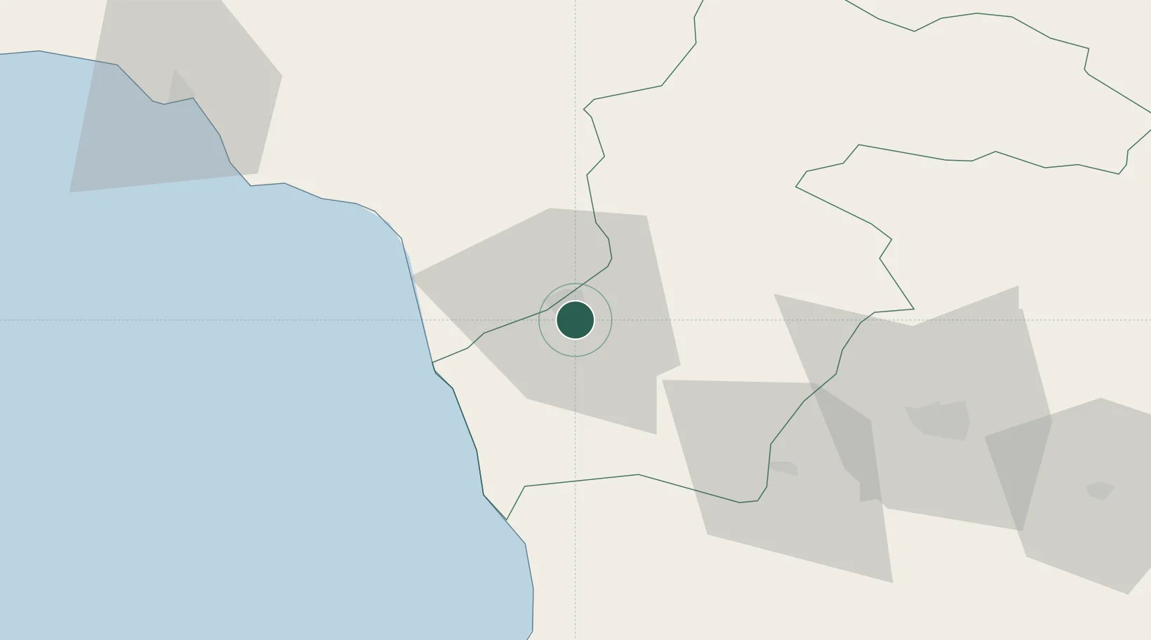
Nearby Logistics Neighbours

Cities
  1. 1Anaklia26 km
  2. 2Tsalenjikha31 km
  3. 3Senaki31 km
  4. 4Kulevi32 km
  5. 5Poti41 km
Nearest neighbours — logibook spatial index (haversine) over the source coordinates
Ports
  1. 1Supsa Marine Terminal46 km
  2. 2Sokhumi90 km
  3. 3Batumi96 km
  4. 4Hopa127 km
  5. 5Rize195 km
Nearest neighbours — logibook spatial index (haversine) over the source coordinates
Airports
  1. 1Senaki Air Base32 km
  2. 2David the Builder Kutaisi International Airport62 km
  3. 3Ozurgeti Air Base64 km
  4. 4Vladislav Ardzinba Sukhum International Airport72 km
  5. 5Mestia Queen Tamar Airport95 km
Nearest neighbours — logibook spatial index (haversine) over the source coordinates
Trade Zones
  1. 1Kulevi Free Industrial Zone32 km
  2. 2Poti Free Industrial Zone39 km
  3. 3Kutaisi Free Industrial Zone - Fresh Georgia, LLC.67 km
  4. 4Kutaisi Free Industrial Zone (Hualing)68 km
  5. 5Trabzon Free Zone242 km
Nearest neighbours — logibook spatial index (haversine) over the source coordinates
DatabookThe Record of Consolidated Knowledge
Georgia beyond logistics?
Browse databook

All Sources

LocationsUN/LOCODE
UN/LOCODE — free
LocationsGeoNames
CC BY 4.0
Portsthe NGA World Port Index
Public domain (US gov)
AirportsOurAirports
Public domain
Trade Zonesthe World Bank SEZ database
CC BY 4.0
Trade ZonesOpen Zone Map
CC BY
← Georgia locations