UN/LOCODE hub · United Kingdom
GBLBE

Loch Buie (Mull)

56.3000°, -5.9000°
1
Transport functions

Transport Functions

Port
UN/LOCODE

Hub Profile

Region
AGB
GeoNames

Location

Location of GBLBE
Natural Earth 10m (public domain) · AGB · GBLBE · 56.30, -5.90GoogleOSMYandex

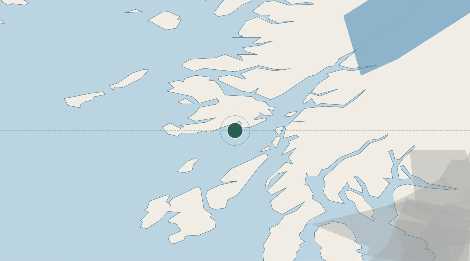
Nearby Logistics Neighbours

Cities
  1. 1Easdale, Seil16 km
  2. 2Ellenabeich, Seil16 km
  3. 3Cuan Ferry, Seil17 km
  4. 4South Cuan, Luing17 km
  5. 5Loch Scridain (Isle Mull)18 km
Nearest neighbours — logibook spatial index (haversine) over the source coordinates
Ports
  1. 1Craignure22 km
  2. 2Lochaline29 km
  3. 3Oban30 km
  4. 4Crinan (Canal)32 km
  5. 5Tobermory37 km
Nearest neighbours — logibook spatial index (haversine) over the source coordinates
Airports
  1. 1Colonsay Airstrip34 km
  2. 2Oban Airport36 km
  3. 3Coll Airport55 km
  4. 4Tiree Airport64 km
  5. 5Islay Airport72 km
Nearest neighbours — logibook spatial index (haversine) over the source coordinates
Trade Zones
  1. 1Prestwick Airport Free Zone119 km
  2. 2Carlisle Kingmoor Park Enterprise Zone239 km
  3. 3Isle of Man Free Zone and Business Park259 km
  4. 4North Eastern Enterprise Zone307 km
  5. 5Dublin International Financial Services Centre329 km
Nearest neighbours — logibook spatial index (haversine) over the source coordinates
DatabookThe Record of Consolidated Knowledge
United Kingdom beyond logistics?
Browse databook

All Sources

LocationsUN/LOCODE
UN/LOCODE — free
Portsthe NGA World Port Index
Public domain (US gov)
AirportsOurAirports
Public domain
Trade Zonesthe World Bank SEZ database
CC BY 4.0
Trade ZonesOpen Zone Map
CC BY
← United Kingdom locations