UN/LOCODE hub · United Kingdom
GBHLO

Holy Loch

55.9833°, -4.9333°
2
Transport functions

Transport Functions

Port
Road
UN/LOCODE

Hub Profile

Region
AGB
GeoNames

Location

Location of GBHLO
Natural Earth 10m (public domain) · AGB · GBHLO · 55.98, -4.93GoogleOSMYandex

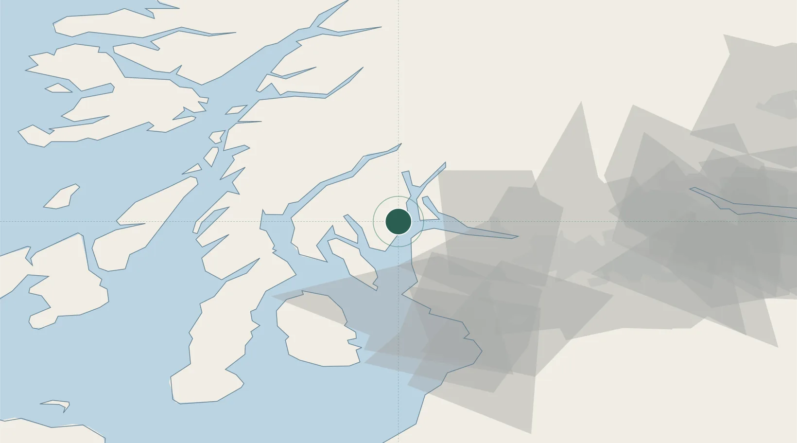
Nearby Logistics Neighbours

Cities
  1. 1Blairmore2 km
  2. 2Dunoon4 km
  3. 3Kilcreggan5 km
  4. 4Ardentinny6 km
  5. 5Gourock7 km
Nearest neighbours — logibook spatial index (haversine) over the source coordinates
Ports
  1. 1Faslane11 km
  2. 2Greenock12 km
  3. 3Finnart Oil Terminal16 km
  4. 4Rothesay Harbor18 km
  5. 5Largs21 km
Nearest neighbours — logibook spatial index (haversine) over the source coordinates
Airports
  1. 1Glasgow Airport34 km
  2. 2Glasgow Prestwick Airport58 km
  3. 3Oban Airport61 km
  4. 4Campbeltown Airport77 km
  5. 5Colonsay Airstrip82 km
Nearest neighbours — logibook spatial index (haversine) over the source coordinates
Trade Zones
  1. 1Prestwick Airport Free Zone56 km
  2. 2Carlisle Kingmoor Park Enterprise Zone170 km
  3. 3Isle of Man Free Zone and Business Park211 km
  4. 4Blackpool Enterprise Zone274 km
  5. 5Hillhouse Enterprise Zone276 km
Nearest neighbours — logibook spatial index (haversine) over the source coordinates
DatabookThe Record of Consolidated Knowledge
United Kingdom beyond logistics?
Browse databook

All Sources

LocationsUN/LOCODE
UN/LOCODE — free
Portsthe NGA World Port Index
Public domain (US gov)
AirportsOurAirports
Public domain
Trade Zonesthe World Bank SEZ database
CC BY 4.0
Trade ZonesOpen Zone Map
CC BY
← United Kingdom locations