UN/LOCODE hub · France
FRTTL

Tourrette-Levens

43.7833°, 7.2833°
4,276
Population
1
Transport functions

Transport Functions

Multimodal
UN/LOCODE

Hub Profile

Place type
Populated place
GeoNames
Region
Provence-Alpes-Côte d'Azur
GeoNames
Population
4,276
GeoNames
Time zone
Europe/Paris
GeoNames
Elevation
393 m
GeoNames

Location

Location of FRTTL
Natural Earth 10m (public domain) · Provence-Alpes-Côte d'Azur · FRTTL · 43.78, 7.28GoogleOSMYandex

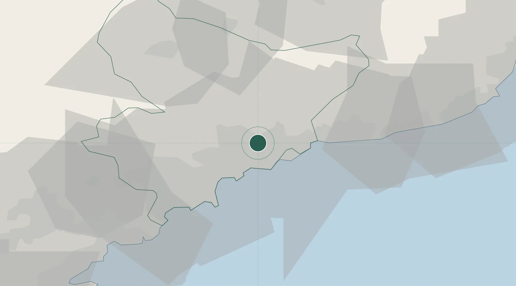
Nearby Logistics Neighbours

Cities
  1. 1Saint-André-de-la-Roche6 km
  2. 2Colomars6 km
  3. 3Nice9 km
  4. 4Villefranche-sur-Mer10 km
  5. 5Gilette12 km
Nearest neighbours — logibook spatial index (haversine) over the source coordinates
Ports
  1. 1Nice9 km
  2. 2Villefranche10 km
  3. 3Monaco12 km
  4. 4Antibes25 km
  5. 5Cannes34 km
Nearest neighbours — logibook spatial index (haversine) over the source coordinates
Airports
  1. 1Monaco Heliport13 km
  2. 2Nice-Côte d'Azur Airport15 km
  3. 3Cannes Croisette Heliport34 km
  4. 4Cannes Mandelieu Airport37 km
  5. 5Riviera Villanova d'Albenga International Airport74 km
Nearest neighbours — logibook spatial index (haversine) over the source coordinates
Trade Zones
  1. 1ZFU LAriane4 km
  2. 2ZFU Toulon131 km
  3. 3ZFU La Seyne-sur-Mer140 km
  4. 4ZFU Marseille 15e et 16e163 km
  5. 5ZFU Saint-Barthélémy, Le Canet, Delorme-Paternelle174 km
Nearest neighbours — logibook spatial index (haversine) over the source coordinates
DatabookThe Record of Consolidated Knowledge
France beyond logistics?
Browse databook

All Sources

LocationsUN/LOCODE
UN/LOCODE — free
LocationsGeoNames
CC BY 4.0
Portsthe NGA World Port Index
Public domain (US gov)
AirportsOurAirports
Public domain
Trade Zonesthe World Bank SEZ database
CC BY 4.0
Trade ZonesOpen Zone Map
CC BY
← France locations