UN/LOCODE hub · France
FRRB3

Rocbaron

43.3000°, 6.0833°
3,218
Population
1
Transport functions

Transport Functions

Multimodal
UN/LOCODE

Hub Profile

Place type
Populated place
GeoNames
Region
Provence-Alpes-Côte d'Azur
GeoNames
Population
3,218
GeoNames
Time zone
Europe/Paris
GeoNames
Elevation
368 m
GeoNames

Location

Location of FRRB3
Natural Earth 10m (public domain) · Provence-Alpes-Côte d'Azur · FRRB3 · 43.30, 6.08GoogleOSMYandex

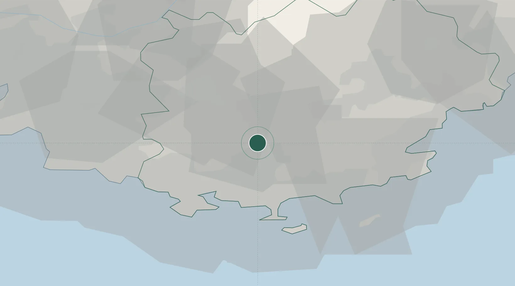
Nearby Logistics Neighbours

Cities
  1. 1Puget-Ville5 km
  2. 2Néoules5 km
  3. 3Carnoules8 km
  4. 4Méounes-lès-Montrieux10 km
  5. 5La Celle12 km
Nearest neighbours — logibook spatial index (haversine) over the source coordinates
Ports
  1. 1Toulon26 km
  2. 2Saint-Tropez45 km
  3. 3Saint-Raphael57 km
  4. 4Marseille58 km
  5. 5Cannes80 km
Nearest neighbours — logibook spatial index (haversine) over the source coordinates
Airports
  1. 1Toulon-Hyères Airport23 km
  2. 2Le Castellet Airport25 km
  3. 3Le Luc-Le Cannet Airfield26 km
  4. 4La Môle Airport34 km
  5. 5Marseille Provence Airport72 km
Nearest neighbours — logibook spatial index (haversine) over the source coordinates
Trade Zones
  1. 1ZFU Toulon23 km
  2. 2ZFU La Seyne-sur-Mer31 km
  3. 3ZFU Marseille 15e et 16e58 km
  4. 4ZFU Saint-Barthélémy, Le Canet, Delorme-Paternelle68 km
  5. 5ZFU LAriane109 km
Nearest neighbours — logibook spatial index (haversine) over the source coordinates
DatabookThe Record of Consolidated Knowledge
France beyond logistics?
Browse databook

All Sources

LocationsUN/LOCODE
UN/LOCODE — free
LocationsGeoNames
CC BY 4.0
Portsthe NGA World Port Index
Public domain (US gov)
AirportsOurAirports
Public domain
Trade Zonesthe World Bank SEZ database
CC BY 4.0
Trade ZonesOpen Zone Map
CC BY
← France locations