UN/LOCODE hub · France
FRER3

Éraville

45.5833°, -0.8333°
184
Population
2
Transport functions

Transport Functions

Road
Multimodal
UN/LOCODE

Hub Profile

Place type
Populated place
GeoNames
Region
Nouvelle-Aquitaine
GeoNames
Population
184
GeoNames
Time zone
Europe/Paris
GeoNames
Elevation
62 m
GeoNames

Location

Location of FRER3
Natural Earth 10m (public domain) · Nouvelle-Aquitaine · FRER3 · 45.58, -0.83GoogleOSMYandex

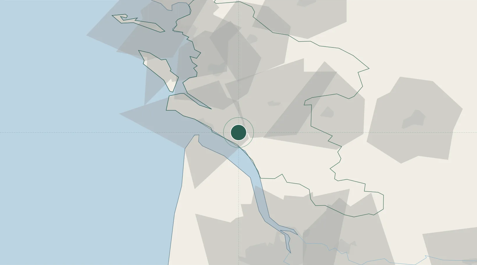
Nearby Logistics Neighbours

Cities
  1. 1Cozes0 km
  2. 2Saint-André-de-Lidon7 km
  3. 3Chenac-Saint-Seurin-d'Uzet7 km
  4. 4Le Chay8 km
  5. 5Talmont-sur-Gironde8 km
Nearest neighbours — logibook spatial index (haversine) over the source coordinates
Ports
  1. 1Le Verdon17 km
  2. 2Tonnay Charente39 km
  3. 3Rochefort40 km
  4. 4Pauillac43 km
  5. 5Blaye52 km
Nearest neighbours — logibook spatial index (haversine) over the source coordinates
Airports
  1. 1Royan-Médis Airport12 km
  2. 2Rochefort-Saint-Agnant (BA 721) Airport36 km
  3. 3Cognac-Châteaubernard (BA 709) Air Base41 km
  4. 4La Rochelle Île de Ré Airport72 km
  5. 5Angoulême Brie-Champniers airport84 km
Nearest neighbours — logibook spatial index (haversine) over the source coordinates
Trade Zones
  1. 1ZFU La Rochelle71 km
  2. 2Port de Bordeaux78 km
  3. 3ZFU Hauts de Garonne86 km
  4. 4ZFU Nantes et Saint-Herblain194 km
  5. 5ZFU Angers212 km
Nearest neighbours — logibook spatial index (haversine) over the source coordinates
DatabookThe Record of Consolidated Knowledge
France beyond logistics?
Browse databook

All Sources

LocationsUN/LOCODE
UN/LOCODE — free
LocationsGeoNames
CC BY 4.0
Portsthe NGA World Port Index
Public domain (US gov)
AirportsOurAirports
Public domain
Trade Zonesthe World Bank SEZ database
CC BY 4.0
Trade ZonesOpen Zone Map
CC BY
← France locations