UN/LOCODE hub · Finland
FISSI

Särkisalmi

61.6000°, 29.4833°
3
Transport functions

Transport Functions

Port
Rail
Road
UN/LOCODE

Hub Profile

Region
02
GeoNames

Location

Location of FISSI
Natural Earth 10m (public domain) · 02 · FISSI · 61.60, 29.48GoogleOSMYandex

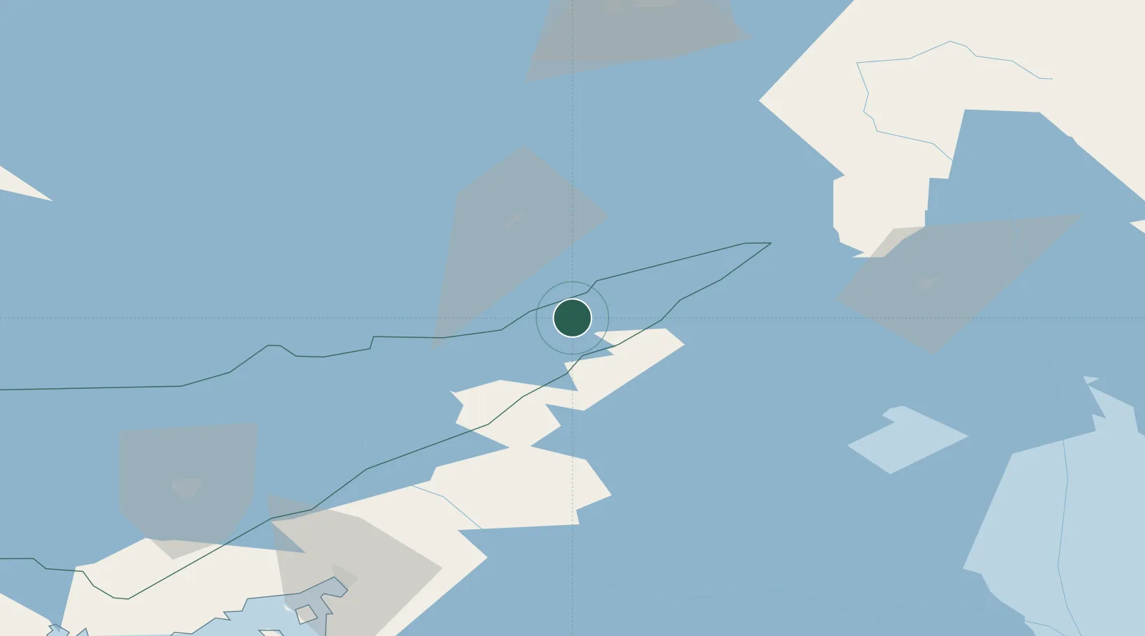
Nearby Logistics Neighbours

Cities
  1. 1Parikkala6 km
  2. 2Kesälahti37 km
  3. 3Nyslott (Savonlinna)43 km
  4. 4Vuoksen Terminal56 km
  5. 5Puhos60 km
Nearest neighbours — logibook spatial index (haversine) over the source coordinates
Ports
  1. 1Vyborg106 km
  2. 2Gavan Vysotsk120 km
  3. 3Primorsk145 km
  4. 4Hamina168 km
  5. 5Kronshtadt181 km
Nearest neighbours — logibook spatial index (haversine) over the source coordinates
Airports
  1. 1Savonlinna Airport48 km
  2. 2Kitee Airport70 km
  3. 3Lappeenranta Airport94 km
  4. 4Varkaus Airport106 km
  5. 5Joensuu Airport118 km
Nearest neighbours — logibook spatial index (haversine) over the source coordinates
Trade Zones
  1. 1Free Zone of Lappeenranta96 km
  2. 2Port of Hamina-Kotka186 km
  3. 3St Petersburg Technology Innovative Special Economic Zone197 km
  4. 4Port of Sillamäe261 km
  5. 5Muuga Free Zone355 km
Nearest neighbours — logibook spatial index (haversine) over the source coordinates
DatabookThe Record of Consolidated Knowledge
Finland beyond logistics?
Browse databook

All Sources

LocationsUN/LOCODE
UN/LOCODE — free
Portsthe NGA World Port Index
Public domain (US gov)
AirportsOurAirports
Public domain
Trade Zonesthe World Bank SEZ database
CC BY 4.0
Trade ZonesOpen Zone Map
CC BY
← Finland locations