UN/LOCODE hub · Spain
ESZFN

Galdar

28.1500°, -15.6500°
24,209
Population
1
Transport functions

Transport Functions

Multimodal
UN/LOCODE

Hub Profile

Place type
District seat
GeoNames
Region
Canary Islands
GeoNames
Population
24,209
GeoNames
Time zone
Atlantic/Canary
GeoNames
Elevation
148 m
GeoNames

Location

Location of ESZFN
Natural Earth 10m (public domain) · Canary Islands · ESZFN · 28.15, -15.65GoogleOSMYandex

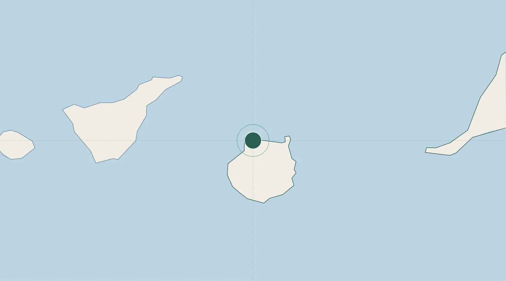
Nearby Logistics Neighbours

Cities
  1. 1Agaete6 km
  2. 2Arucas14 km
  3. 3Arucas14 km
  4. 4El Chorrillo19 km
  5. 5Santa Brigida20 km
Nearest neighbours — logibook spatial index (haversine) over the source coordinates
Ports
  1. 1Las Palmas23 km
  2. 2Santa Cruz De Tenerife67 km
  3. 3Puerto Del Rosario180 km
  4. 4Santa Cruz De La Palma214 km
  5. 5Arrecife225 km
Nearest neighbours — logibook spatial index (haversine) over the source coordinates
Airports
  1. 1Gran Canaria Airport35 km
  2. 2Tenerife Norte-Ciudad de La Laguna Airport77 km
  3. 3Tenerife Sur Airport91 km
  4. 4La Gomera Airport154 km
  5. 5Fuerteventura Airport178 km
Nearest neighbours — logibook spatial index (haversine) over the source coordinates
Trade Zones
  1. 1Zona Franca de Las Palmas de Gran Canaria24 km
  2. 2Zona Franca de Tenerife69 km
  3. 3Centro Internacional De Negocios da Madeira515 km
  4. 4Bîr Oum Ghrïn Free Zone519 km
  5. 5Omrane Sahel Industrial Zone766 km
Nearest neighbours — logibook spatial index (haversine) over the source coordinates
DatabookThe Record of Consolidated Knowledge
Spain beyond logistics?
Browse databook

All Sources

LocationsUN/LOCODE
UN/LOCODE — free
LocationsGeoNames
CC BY 4.0
Portsthe NGA World Port Index
Public domain (US gov)
AirportsOurAirports
Public domain
Trade Zonesthe World Bank SEZ database
CC BY 4.0
Trade ZonesOpen Zone Map
CC BY
← Spain locations