UN/LOCODE hub · Estonia
EEUIS

Uisusadam

58.5500°, 23.0833°
1
Transport functions

Transport Functions

Port
UN/LOCODE

Hub Profile

Region
74
GeoNames

Location

Location of EEUIS
Natural Earth 10m (public domain) · 74 · EEUIS · 58.55, 23.08GoogleOSMYandex

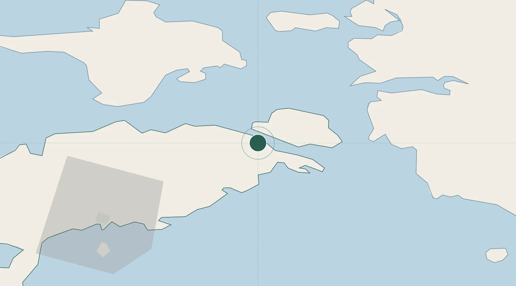
Nearby Logistics Neighbours

Cities
  1. 1Orissaare2 km
  2. 2Koguva6 km
  3. 3Taaliku Sadam8 km
  4. 4Valmeranna10 km
  5. 5Lõpesuu13 km
Nearest neighbours — logibook spatial index (haversine) over the source coordinates
Ports
  1. 1Virtsu25 km
  2. 2Heltermaa35 km
  3. 3Rohukula44 km
  4. 4Saaremaa sadam49 km
  5. 5Roomassaare50 km
Nearest neighbours — logibook spatial index (haversine) over the source coordinates
Airports
  1. 1Kuressaare Airport49 km
  2. 2Kärdla Airport51 km
  3. 3Pärnu Airport82 km
  4. 4Ruhnu Airfield86 km
  5. 5Ämari Air Base102 km
Nearest neighbours — logibook spatial index (haversine) over the source coordinates
Trade Zones
  1. 1Paldiski Free Zone104 km
  2. 2Muuga Free Zone138 km
  3. 3Freeport of Hanko143 km
  4. 4Free port of Ventspils158 km
  5. 5Free Port of Riga187 km
Nearest neighbours — logibook spatial index (haversine) over the source coordinates
DatabookThe Record of Consolidated Knowledge
Estonia beyond logistics?
Browse databook

All Sources

LocationsUN/LOCODE
UN/LOCODE — free
Portsthe NGA World Port Index
Public domain (US gov)
AirportsOurAirports
Public domain
Trade Zonesthe World Bank SEZ database
CC BY 4.0
Trade ZonesOpen Zone Map
CC BY
← Estonia locations