UN/LOCODE hub · Estonia
EESVI

Sviby

58.9667°, 23.3167°
1
Transport functions

Transport Functions

Port
UN/LOCODE

Hub Profile

Place type
Populated place
GeoNames
Region
Lääne
GeoNames
Time zone
Europe/Tallinn
GeoNames
Elevation
8 m
GeoNames

Location

Location of EESVI
Natural Earth 10m (public domain) · Lääne · EESVI · 58.97, 23.32GoogleOSMYandex

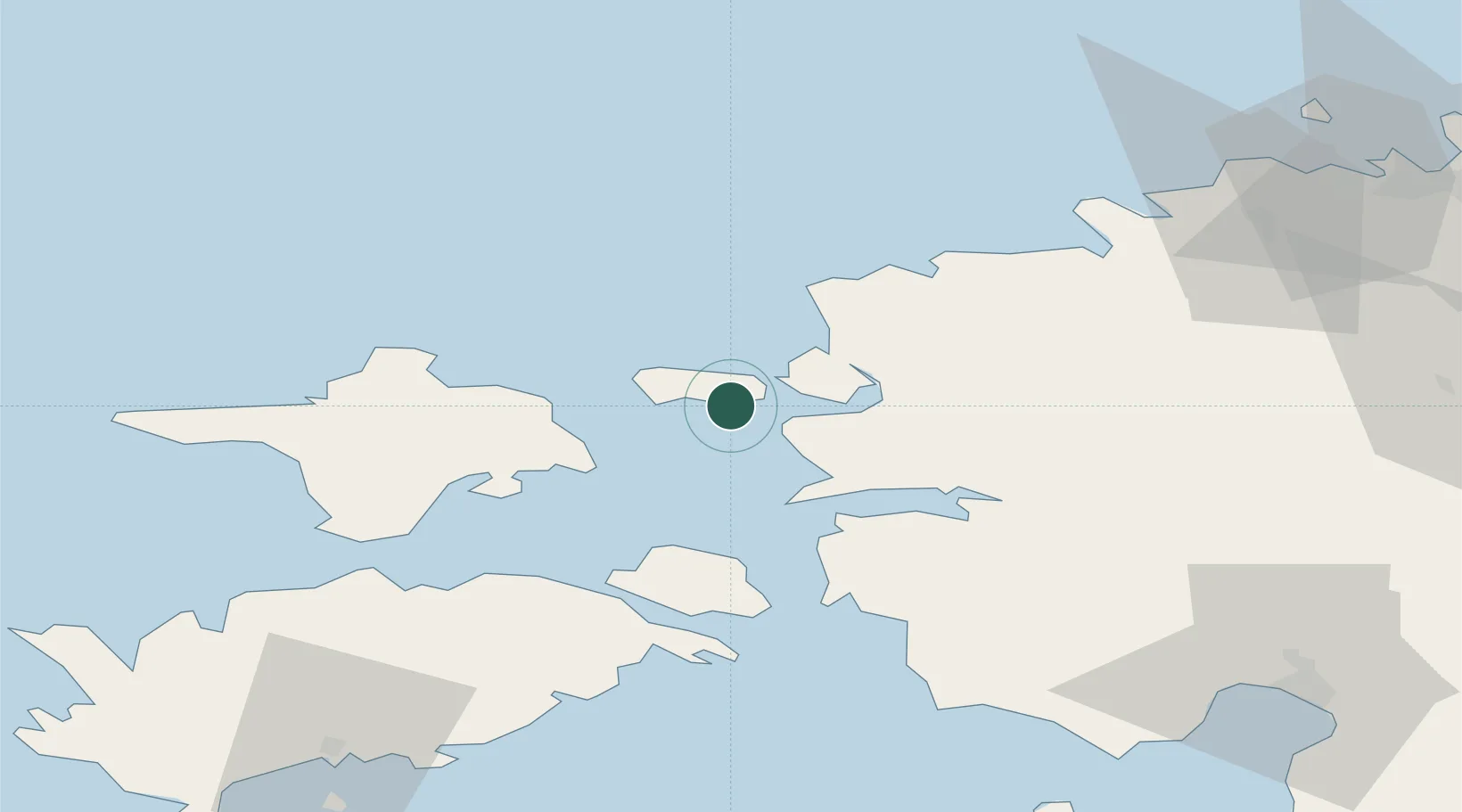
Nearby Logistics Neighbours

Cities
  1. 1Rälby Sadam8 km
  2. 2Paslepa-Viigi Sadam9 km
  3. 3Rohuküla10 km
  4. 4Westmeri12 km
  5. 5Österby12 km
Nearest neighbours — logibook spatial index (haversine) over the source coordinates
Ports
  1. 1Rohukula9 km
  2. 2Heltermaa19 km
  3. 3Osmussaar37 km
  4. 4Virtsu45 km
  5. 5Paldiski Pohjasadam60 km
Nearest neighbours — logibook spatial index (haversine) over the source coordinates
Airports
  1. 1Kärdla Airport28 km
  2. 2Ämari Air Base60 km
  3. 3Pärnu Airport90 km
  4. 4Kuressaare Airport94 km
  5. 5Tallinn Linnahall Heliport98 km
Nearest neighbours — logibook spatial index (haversine) over the source coordinates
Trade Zones
  1. 1Paldiski Free Zone60 km
  2. 2Freeport of Hanko99 km
  3. 3Muuga Free Zone103 km
  4. 4Turku Free Zone176 km
  5. 5Free port of Ventspils203 km
Nearest neighbours — logibook spatial index (haversine) over the source coordinates
DatabookThe Record of Consolidated Knowledge
Estonia beyond logistics?
Browse databook

All Sources

LocationsUN/LOCODE
UN/LOCODE — free
Portsthe NGA World Port Index
Public domain (US gov)
AirportsOurAirports
Public domain
Trade Zonesthe World Bank SEZ database
CC BY 4.0
Trade ZonesOpen Zone Map
CC BY
← Estonia locations