UN/LOCODE hub · Estonia
EESMA

Saaremaa sadam

58.5333°, 22.2333°
3
Transport functions

Transport Functions

Port
Road
Border Crossing
Saaremaa sadam is also a profiled seaport →
UN/LOCODE

Hub Profile

Region
74
GeoNames

Location

Location of EESMA
Natural Earth 10m (public domain) · 74 · EESMA · 58.53, 22.23GoogleOSMYandex

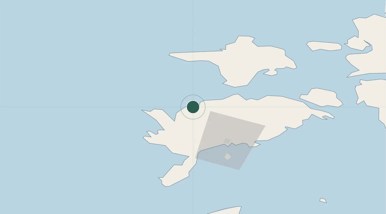
Nearby Logistics Neighbours

Cities
  1. 1Varese Sadam11 km
  2. 2Veere13 km
  3. 3Veere Vanasadam13 km
  4. 4Abaja Sadam22 km
  5. 5Soela23 km
Nearest neighbours — logibook spatial index (haversine) over the source coordinates
Ports
  1. 1Roomassaare39 km
  2. 2Heltermaa60 km
  3. 3Virtsu74 km
  4. 4Rohukula80 km
  5. 5Osmussaar107 km
Nearest neighbours — logibook spatial index (haversine) over the source coordinates
Airports
  1. 1Kuressaare Airport37 km
  2. 2Kärdla Airport61 km
  3. 3Ruhnu Airfield103 km
  4. 4Pärnu Airport131 km
  5. 5Ämari Air Base139 km
Nearest neighbours — logibook spatial index (haversine) over the source coordinates
Trade Zones
  1. 1Free port of Ventspils133 km
  2. 2Paldiski Free Zone138 km
  3. 3Freeport of Hanko149 km
  4. 4Muuga Free Zone181 km
  5. 5Free Port of Riga207 km
Nearest neighbours — logibook spatial index (haversine) over the source coordinates
DatabookThe Record of Consolidated Knowledge
Estonia beyond logistics?
Browse databook

All Sources

LocationsUN/LOCODE
UN/LOCODE — free
Portsthe NGA World Port Index
Public domain (US gov)
AirportsOurAirports
Public domain
Trade Zonesthe World Bank SEZ database
CC BY 4.0
Trade ZonesOpen Zone Map
CC BY
← Estonia locations