UN/LOCODE hub · Estonia
EEKEJ

Kesse-Jaani

58.6333°, 23.4500°
1
Transport functions

Transport Functions

Port
UN/LOCODE

Hub Profile

Region
74
GeoNames

Location

Location of EEKEJ
Natural Earth 10m (public domain) · 74 · EEKEJ · 58.63, 23.45GoogleOSMYandex

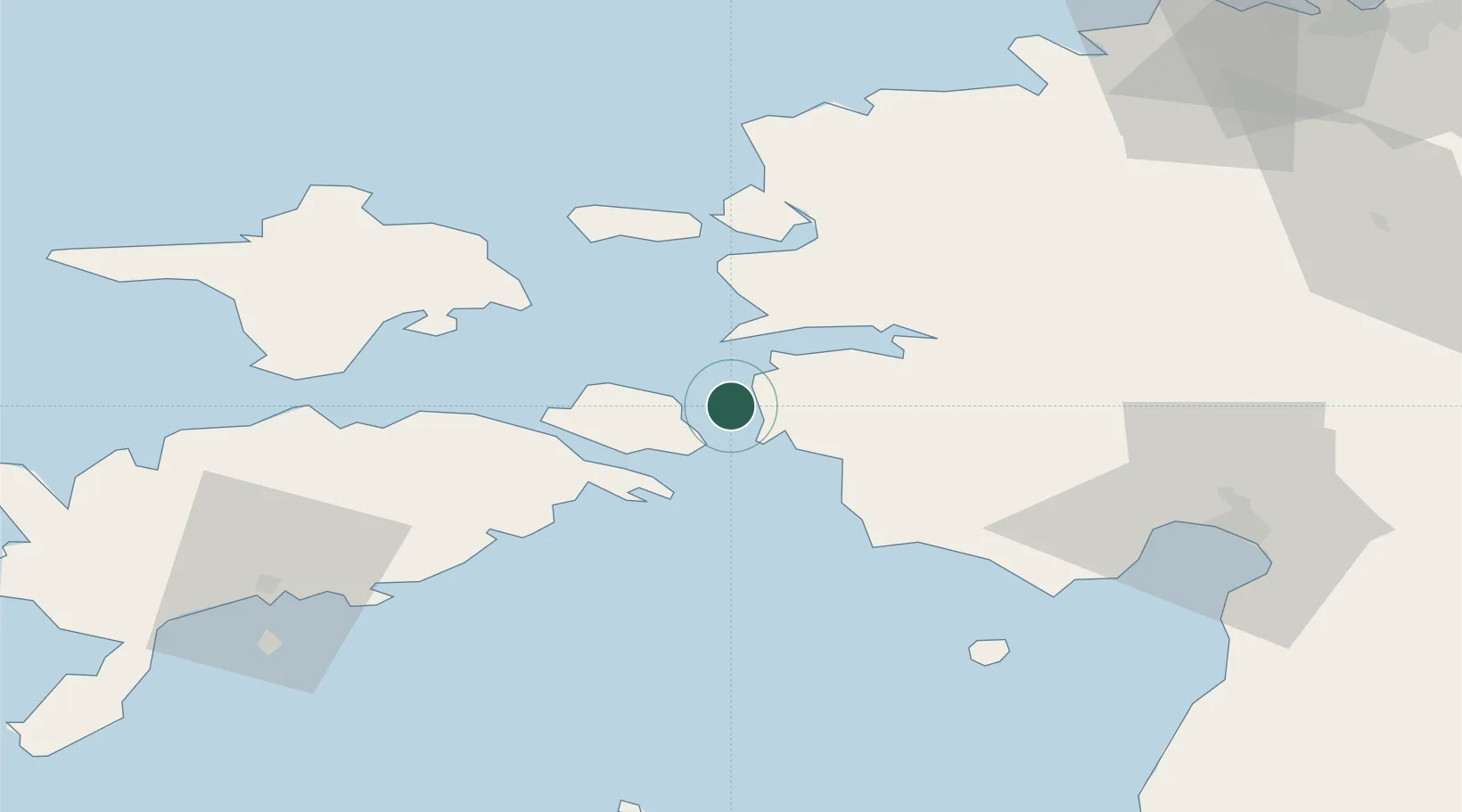
Nearby Logistics Neighbours

Cities
  1. 1Virtsu7 km
  2. 2Virtsu Kalasadam7 km
  3. 3Kuivastu8 km
  4. 4Virtsu Vanasadam9 km
  5. 5Kallaste11 km
Nearest neighbours — logibook spatial index (haversine) over the source coordinates
Ports
  1. 1Virtsu7 km
  2. 2Rohukula30 km
  3. 3Heltermaa35 km
  4. 4Parnu66 km
  5. 5Saaremaa sadam71 km
Nearest neighbours — logibook spatial index (haversine) over the source coordinates
Airports
  1. 1Kärdla Airport53 km
  2. 2Pärnu Airport64 km
  3. 3Kuressaare Airport71 km
  4. 4Ämari Air Base82 km
  5. 5Ruhnu Airfield95 km
Nearest neighbours — logibook spatial index (haversine) over the source coordinates
Trade Zones
  1. 1Paldiski Free Zone86 km
  2. 2Muuga Free Zone116 km
  3. 3Freeport of Hanko137 km
  4. 4Free port of Ventspils178 km
  5. 5Free Port of Riga190 km
Nearest neighbours — logibook spatial index (haversine) over the source coordinates
DatabookThe Record of Consolidated Knowledge
Estonia beyond logistics?
Browse databook

All Sources

LocationsUN/LOCODE
UN/LOCODE — free
Portsthe NGA World Port Index
Public domain (US gov)
AirportsOurAirports
Public domain
Trade Zonesthe World Bank SEZ database
CC BY 4.0
Trade ZonesOpen Zone Map
CC BY
← Estonia locations