UN/LOCODE hub · Estonia
EEAEB

Aasmäe

59.2333°, 24.5000°
1
Transport functions

Transport Functions

Multimodal
UN/LOCODE

Hub Profile

Region
37
GeoNames

Location

Location of EEAEB
Natural Earth 10m (public domain) · 37 · EEAEB · 59.23, 24.50GoogleOSMYandex

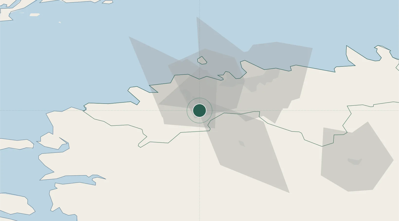
Nearby Logistics Neighbours

Cities
  1. 1Keila9 km
  2. 2Saue10 km
  3. 3Tõdva12 km
  4. 4Saku12 km
  5. 5Alliku13 km
Nearest neighbours — logibook spatial index (haversine) over the source coordinates
Ports
  1. 1Meeruse26 km
  2. 2Paldiski Lounasadam26 km
  3. 3Bekkeri26 km
  4. 4Vene-Balti26 km
  5. 5Lahesuu27 km
Nearest neighbours — logibook spatial index (haversine) over the source coordinates
Airports
  1. 1Ämari Air Base17 km
  2. 2Lennart Meri Tallinn Airport28 km
  3. 3Tallinn Linnahall Heliport28 km
  4. 4Pärnu Airport91 km
  5. 5Kärdla Airport99 km
Nearest neighbours — logibook spatial index (haversine) over the source coordinates
Trade Zones
  1. 1Paldiski Free Zone27 km
  2. 2Muuga Free Zone30 km
  3. 3Freeport of Hanko113 km
  4. 4Port of Sillamäe184 km
  5. 5Turku Free Zone186 km
Nearest neighbours — logibook spatial index (haversine) over the source coordinates
DatabookThe Record of Consolidated Knowledge
Estonia beyond logistics?
Browse databook

All Sources

LocationsUN/LOCODE
UN/LOCODE — free
Portsthe NGA World Port Index
Public domain (US gov)
AirportsOurAirports
Public domain
Trade Zonesthe World Bank SEZ database
CC BY 4.0
Trade ZonesOpen Zone Map
CC BY
← Estonia locations