UN/LOCODE hub · Dominican Republic
DOCDC

Casa de Campo

18.4000°, -68.9000°
1
Transport functions

Transport Functions

Port
UN/LOCODE

Hub Profile

Region
12
GeoNames

Location

Location of DOCDC
Natural Earth 10m (public domain) · 12 · DOCDC · 18.40, -68.90GoogleOSMYandex

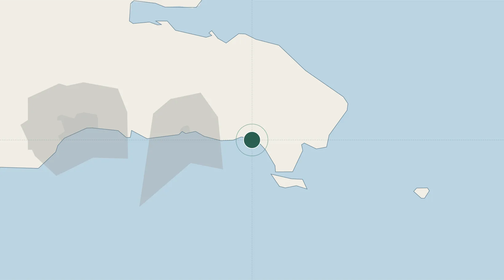
Nearby Logistics Neighbours

Cities
  1. 1Catalina Island11 km
  2. 2San Pedro de Macorís43 km
  3. 3Juan Dolio55 km
  4. 4Caucedo79 km
  5. 5Guerra86 km
Nearest neighbours — logibook spatial index (haversine) over the source coordinates
Ports
  1. 1La Romana7 km
  2. 2San Pedro De Macoris44 km
  3. 3Andres (Andres Lng Terminal)78 km
  4. 4Santa Barbara De Samana100 km
  5. 5Santo Domingo104 km
Nearest neighbours — logibook spatial index (haversine) over the source coordinates
Airports
  1. 1Casa De Campo International Airport6 km
  2. 2Punta Cana International Airport59 km
  3. 3Los Llanos de Sabanatosa Airport70 km
  4. 4Las Américas International Airport81 km
  5. 5San Isidro Air Base92 km
Nearest neighbours — logibook spatial index (haversine) over the source coordinates
Trade Zones
  1. 1La Romana I Industrial Free Zone6 km
  2. 2Zona Franca La Romana7 km
  3. 3La Romana II Industrial Free Zone10 km
  4. 4Zona Franca Industrial Higuey30 km
  5. 5Zona Franca Industrial San Pedro de Macoris41 km
Nearest neighbours — logibook spatial index (haversine) over the source coordinates
DatabookThe Record of Consolidated Knowledge
Dominican Republic beyond logistics?
Browse databook

All Sources

LocationsUN/LOCODE
UN/LOCODE — free
Portsthe NGA World Port Index
Public domain (US gov)
AirportsOurAirports
Public domain
Trade Zonesthe World Bank SEZ database
CC BY 4.0
Trade ZonesOpen Zone Map
CC BY
← Dominican Republic locations