UN/LOCODE hub · Denmark
DKVG4

Væggerløse

54.7000°, 11.9333°
2
Transport functions

Transport Functions

Port
Road
UN/LOCODE

Hub Profile

Region
85
GeoNames

Location

Location of DKVG4
Natural Earth 10m (public domain) · 85 · DKVG4 · 54.70, 11.93GoogleOSMYandex

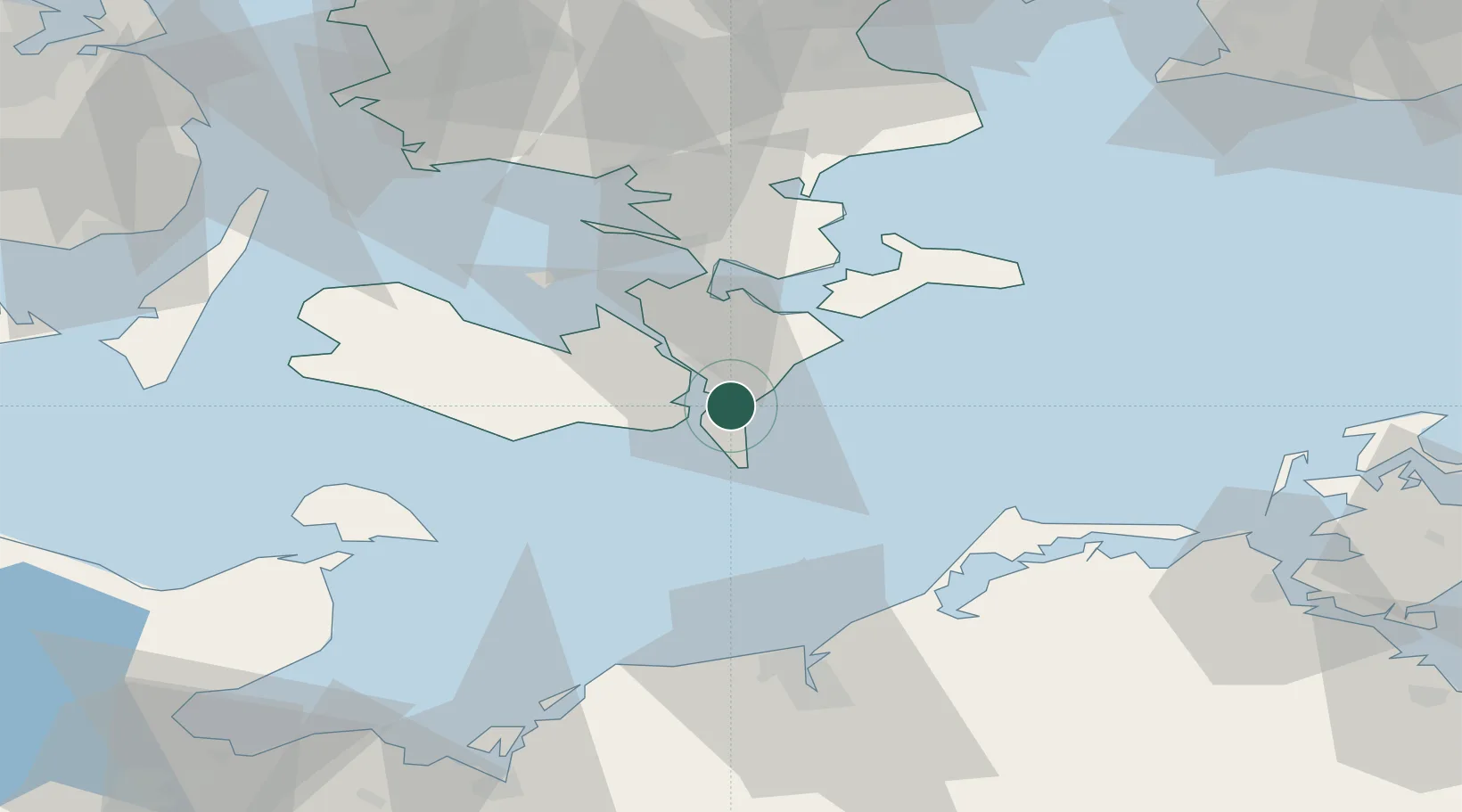
Nearby Logistics Neighbours

Cities
  1. 1Nykøbing Falster8 km
  2. 2Toreby10 km
  3. 3Kettinge12 km
  4. 4Reersoe21 km
  5. 5Stubbekøbing22 km
Nearest neighbours — logibook spatial index (haversine) over the source coordinates
Ports
  1. 1Nykobing9 km
  2. 2Nysted13 km
  3. 3Stubbekobing22 km
  4. 4Sakskobing22 km
  5. 5Bandholm32 km
Nearest neighbours — logibook spatial index (haversine) over the source coordinates
Airports
  1. 1Lolland Falster Maribo Airport32 km
  2. 2Ringsted Airfield81 km
  3. 3Rostock-Laage Airport90 km
  4. 4Sydfyn (Tasinge) Airfield95 km
  5. 5Ærø Airfield96 km
Nearest neighbours — logibook spatial index (haversine) over the source coordinates
Trade Zones
  1. 1Freeport of Copenhagen- Nordhavn121 km
  2. 2Freeport of Kiel121 km
  3. 3MTS Malmö Transport and Spedition125 km
  4. 4Swinoujscie Duty Free Zone176 km
  5. 5Szczecin Duty Free Zone223 km
Nearest neighbours — logibook spatial index (haversine) over the source coordinates
DatabookThe Record of Consolidated Knowledge
Denmark beyond logistics?
Browse databook

All Sources

LocationsUN/LOCODE
UN/LOCODE — free
Portsthe NGA World Port Index
Public domain (US gov)
AirportsOurAirports
Public domain
Trade Zonesthe World Bank SEZ database
CC BY 4.0
Trade ZonesOpen Zone Map
CC BY
← Denmark locations