UN/LOCODE hub · Denmark
DKSNY

Sundby/Mors

56.8667°, 8.6667°
2
Transport functions

Transport Functions

Port
Road
UN/LOCODE

Hub Profile

Region
81
GeoNames

Location

Location of DKSNY
Natural Earth 10m (public domain) · 81 · DKSNY · 56.87, 8.67GoogleOSMYandex

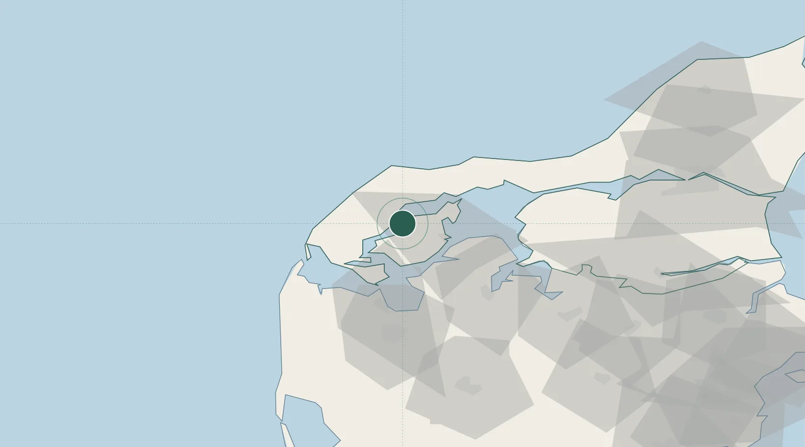
Nearby Logistics Neighbours

Cities
  1. 1Nykøbing Mors15 km
  2. 2Hurup Thy20 km
  3. 3Thyholm26 km
  4. 4Thyborøn33 km
  5. 5Strandby35 km
Nearest neighbours — logibook spatial index (haversine) over the source coordinates
Ports
  1. 1Thisted10 km
  2. 2Hanstholm30 km
  3. 3Thyboron33 km
  4. 4Lemvig39 km
  5. 5Holstebro-Stuer41 km
Nearest neighbours — logibook spatial index (haversine) over the source coordinates
Airports
  1. 1Thisted Airport23 km
  2. 2Skive Airport47 km
  3. 3Midtjyllands Airport / Air Base Karup69 km
  4. 4Aalborg Airport76 km
  5. 5Stauning Vestjylland Airport99 km
Nearest neighbours — logibook spatial index (haversine) over the source coordinates
Trade Zones
  1. 1Gothenburg Boundless Customs Warehouse211 km
  2. 2Freeport of Copenhagen- Nordhavn275 km
  3. 3Freeport of Kiel297 km
  4. 4MTS Malmö Transport and Spedition307 km
  5. 5Freeport of Cuxhaven (Freihafen Cuxhaven)338 km
Nearest neighbours — logibook spatial index (haversine) over the source coordinates
DatabookThe Record of Consolidated Knowledge
Denmark beyond logistics?
Browse databook

All Sources

LocationsUN/LOCODE
UN/LOCODE — free
Portsthe NGA World Port Index
Public domain (US gov)
AirportsOurAirports
Public domain
Trade Zonesthe World Bank SEZ database
CC BY 4.0
Trade ZonesOpen Zone Map
CC BY
← Denmark locations