UN/LOCODE hub · Germany
DENUE

Nürnberg

49.3981°, 11.0531°
4
Transport functions

Transport Functions

Port
Rail
Road
Airport
UN/LOCODE

Hub Profile

Region
BY
GeoNames
Logistics facilities
4
UN/LOCODE

Location

Location of DENUE
Natural Earth 10m (public domain) · BY · DENUE · 49.40, 11.05GoogleOSMYandex

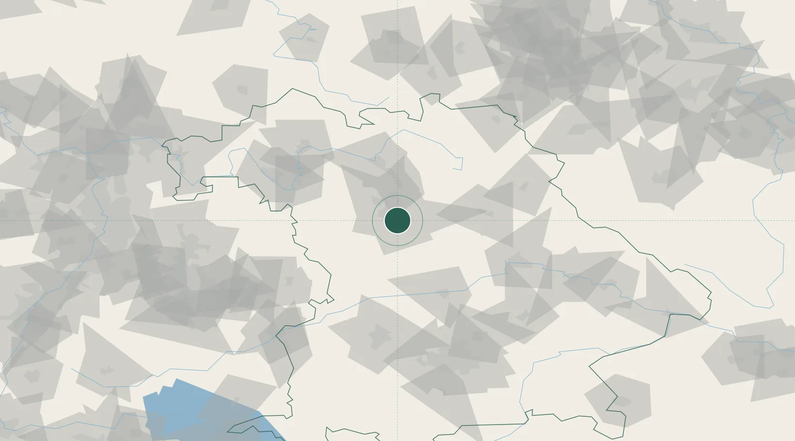
Nearby Logistics Neighbours

Cities
  1. 1Oberasbach bei Nürnberg8 km
  2. 2Zirndorf9 km
  3. 3Fürth10 km
  4. 4Schwanstetten12 km
  5. 5Rosstal12 km
Nearest neighbours — logibook spatial index (haversine) over the source coordinates
Ports
  1. 1Nogaro435 km
  2. 2Monfalcone443 km
  3. 3Grado445 km
  4. 4Bremen445 km
  5. 5Porto Di Lido-Venezia455 km
Nearest neighbours — logibook spatial index (haversine) over the source coordinates
Airports
  1. 1Nuremberg Airport11 km
  2. 2Bamberg-Breitenau Airfield59 km
  3. 3Hohenfels Army Airfield60 km
  4. 4Grafenwöhr Army Air Field72 km
  5. 5Neuburg Air Base77 km
Nearest neighbours — logibook spatial index (haversine) over the source coordinates
Trade Zones
  1. 1Freeport of Deggendorf148 km
  2. 2Podbořany Industrial Zone192 km
  3. 3Žatec - Triangle Strategic Industrial Zone209 km
  4. 4Most - Joseph Industrial Zone221 km
  5. 5ZFU Neuhof258 km
Nearest neighbours — logibook spatial index (haversine) over the source coordinates
DatabookThe Record of Consolidated Knowledge
Germany beyond logistics?
Browse databook

All Sources

LocationsUN/LOCODE
UN/LOCODE — free
Portsthe NGA World Port Index
Public domain (US gov)
AirportsOurAirports
Public domain
Trade Zonesthe World Bank SEZ database
CC BY 4.0
Trade ZonesOpen Zone Map
CC BY
← Germany locations