UN/LOCODE hub · Germany
DEGOK

Grosskoschen

51.5000°, 14.0500°
2
Transport functions

Transport Functions

Rail
Road
UN/LOCODE

Hub Profile

Place type
Populated place
GeoNames
Region
Brandenburg
GeoNames
Time zone
Europe/Berlin
GeoNames
Elevation
110 m
GeoNames

Location

Location of DEGOK
Natural Earth 10m (public domain) · Brandenburg · DEGOK · 51.50, 14.05GoogleOSMYandex

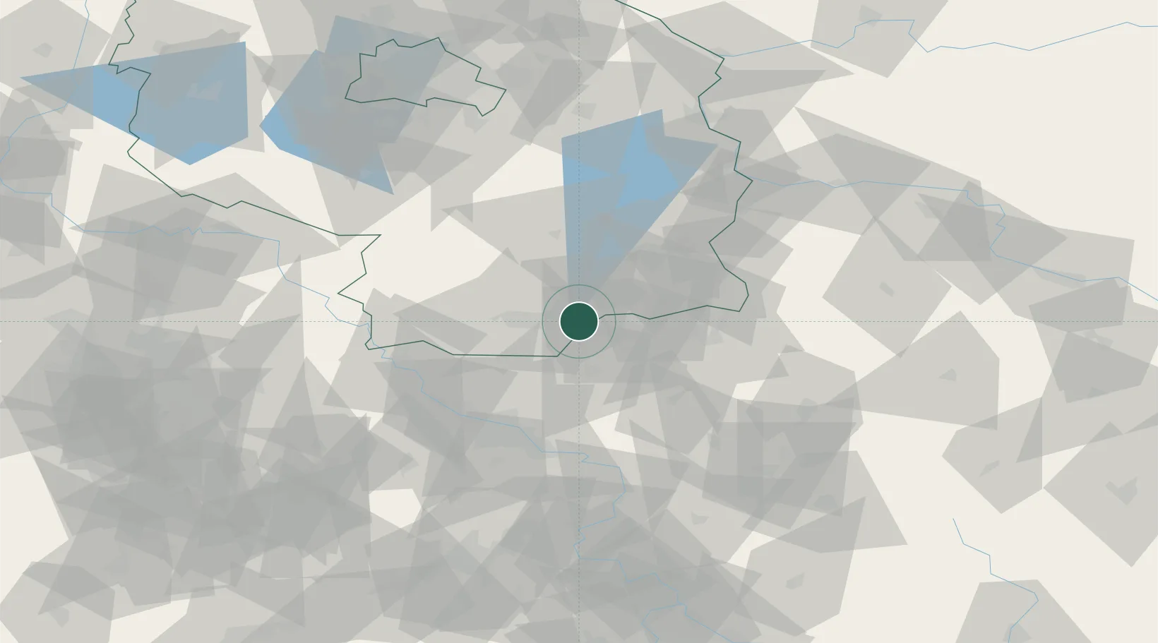
Nearby Logistics Neighbours

Cities
  1. 1Senftenberg3 km
  2. 2Hohenbocka8 km
  3. 3Grossräschen10 km
  4. 4Welzow12 km
  5. 5Guteborn12 km
Nearest neighbours — logibook spatial index (haversine) over the source coordinates
Ports
  1. 1Szczecin216 km
  2. 2Police232 km
  3. 3Swinoujscie269 km
  4. 4Wolgast284 km
  5. 5Rostock317 km
Nearest neighbours — logibook spatial index (haversine) over the source coordinates
Airports
  1. 1Dresden Airport45 km
  2. 2Rothenburg/Görlitz Airfield64 km
  3. 3Holzdorf Air Base68 km
  4. 4Berlin Brandenburg Airport103 km
  5. 5Leipzig–Altenburg Airport122 km
Nearest neighbours — logibook spatial index (haversine) over the source coordinates
Trade Zones
  1. 1Most - Joseph Industrial Zone116 km
  2. 2Žatec - Triangle Strategic Industrial Zone128 km
  3. 3Kostrzyń-Słubice SEZ128 km
  4. 4Legnica SEZ (Legnicka SSE)133 km
  5. 5Podbořany Industrial Zone149 km
Nearest neighbours — logibook spatial index (haversine) over the source coordinates
DatabookThe Record of Consolidated Knowledge
Germany beyond logistics?
Browse databook

All Sources

LocationsUN/LOCODE
UN/LOCODE — free
Portsthe NGA World Port Index
Public domain (US gov)
AirportsOurAirports
Public domain
Trade Zonesthe World Bank SEZ database
CC BY 4.0
Trade ZonesOpen Zone Map
CC BY
← Germany locations