UN/LOCODE hub · Czechia
CZKAL

Antoninuv Dul

50.5833°, 15.2500°
1
Transport functions

Transport Functions

Multimodal
UN/LOCODE

Hub Profile

Region
KR
GeoNames

Location

Location of CZKAL
Natural Earth 10m (public domain) · KR · CZKAL · 50.58, 15.25GoogleOSMYandex

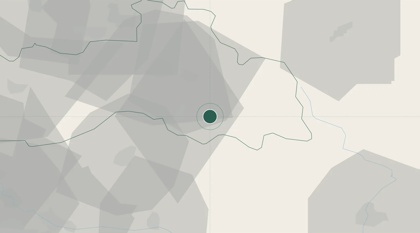
Nearby Logistics Neighbours

Cities
  1. 1Chuchelna3 km
  2. 2Odolenovice9 km
  3. 3Lomnice nad Popelkou10 km
  4. 4Konojedy12 km
  5. 5Libstát12 km
Nearest neighbours — logibook spatial index (haversine) over the source coordinates
Ports
  1. 1Szczecin319 km
  2. 2Police335 km
  3. 3Swinoujscie377 km
  4. 4Wolgast398 km
  5. 5Kolobrzeg405 km
Nearest neighbours — logibook spatial index (haversine) over the source coordinates
Airports
  1. 1Kostomlaty Airstrip48 km
  2. 2Prague–Kbely Air Base72 km
  3. 3Pardubice Airport72 km
  4. 4Čáslav Air Base72 km
  5. 5Vodochody Airport73 km
Nearest neighbours — logibook spatial index (haversine) over the source coordinates
Trade Zones
  1. 1Kolín - Ovčáry Industrial Zone57 km
  2. 2Kamienna Góra59 km
  3. 3Industrial Zone Kutna Hora72 km
  4. 4Pardubice City Industrial Zone74 km
  5. 5Wałbrzych SEZ INVEST-PARK (Wałbrzyska SSE)79 km
Nearest neighbours — logibook spatial index (haversine) over the source coordinates
DatabookThe Record of Consolidated Knowledge
Czechia beyond logistics?
Browse databook

All Sources

LocationsUN/LOCODE
UN/LOCODE — free
Portsthe NGA World Port Index
Public domain (US gov)
AirportsOurAirports
Public domain
Trade Zonesthe World Bank SEZ database
CC BY 4.0
Trade ZonesOpen Zone Map
CC BY
← Czechia locations