UN/LOCODE hub · Cyprus
CYLAT

Latchi

35.0333°, 32.4000°
2
Transport functions

Transport Functions

Port
Road
UN/LOCODE

Hub Profile

Region
05
GeoNames

Location

Location of CYLAT
Natural Earth 10m (public domain) · 05 · CYLAT · 35.03, 32.40GoogleOSMYandex

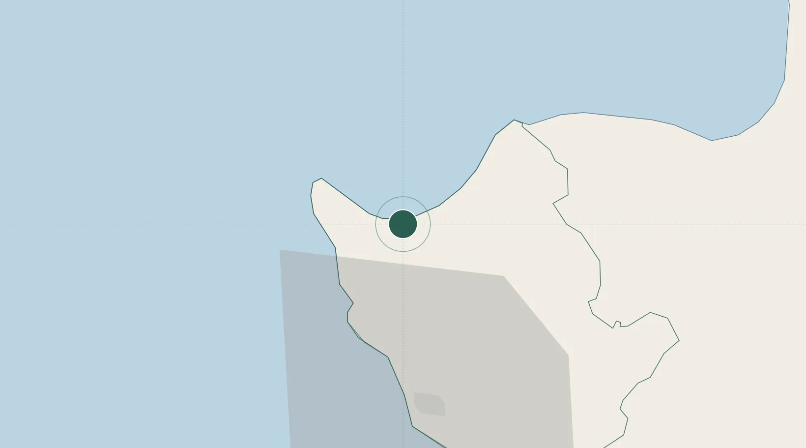
Nearby Logistics Neighbours

Cities
  1. 1Paphos30 km
  2. 2Karavostasi41 km
  3. 3Limassol69 km
  4. 4Akrotiri70 km
  5. 5Moni80 km
Nearest neighbours — logibook spatial index (haversine) over the source coordinates
Ports
  1. 1Xeros41 km
  2. 2Limassol72 km
  3. 3Kyrenia92 km
  4. 4Larnaca115 km
  5. 5Dhekelia120 km
Nearest neighbours — logibook spatial index (haversine) over the source coordinates
Airports
  1. 1Paphos International Airport36 km
  2. 2RAF Akrotiri73 km
  3. 3Ercan International Airport102 km
  4. 4Larnaca International Airport113 km
  5. 5Lefkoniko Airport / Geçitkale Air Base122 km
Nearest neighbours — logibook spatial index (haversine) over the source coordinates
Trade Zones
  1. 1Limassol Free Port71 km
  2. 2Larnaca Free Zone107 km
  3. 3Famagusta Free Port and Zone141 km
  4. 4Karaman Organized Industrial Zone256 km
  5. 5Antalya Free Zone258 km
Nearest neighbours — logibook spatial index (haversine) over the source coordinates
DatabookThe Record of Consolidated Knowledge
Cyprus beyond logistics?
Browse databook

All Sources

LocationsUN/LOCODE
UN/LOCODE — free
Portsthe NGA World Port Index
Public domain (US gov)
AirportsOurAirports
Public domain
Trade Zonesthe World Bank SEZ database
CC BY 4.0
Trade ZonesOpen Zone Map
CC BY
← Cyprus locations