UN/LOCODE hub · Costa Rica
CRSLN

Salinas

9.9333°, -84.6833°
2
Transport functions

Transport Functions

Road
Multimodal
UN/LOCODE

Hub Profile

Place type
Populated place
GeoNames
Region
Puntarenas Province
GeoNames
Time zone
America/Costa_Rica
GeoNames
Elevation
31 m
GeoNames

Location

Location of CRSLN
Natural Earth 10m (public domain) · Puntarenas Province · CRSLN · 9.93, -84.68GoogleOSMYandex

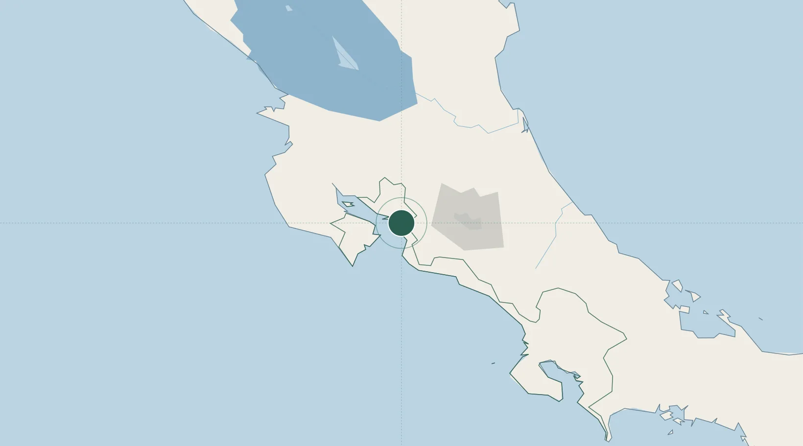
Nearby Logistics Neighbours

Cities
  1. 1Puerto Caldera4 km
  2. 2Esparza6 km
  3. 3Barranca7 km
  4. 4Caldera7 km
  5. 5Coyolar13 km
Nearest neighbours — logibook spatial index (haversine) over the source coordinates
Ports
  1. 1Puerto Caldera4 km
  2. 2Puntarenas17 km
  3. 3Puerto Quepos79 km
  4. 4Puerto Moin175 km
  5. 5Puerto Limon183 km
Nearest neighbours — logibook spatial index (haversine) over the source coordinates
Airports
  1. 1Juan Santamaría International Airport52 km
  2. 2Tobías Bolaños International Airport60 km
  3. 3La Fortuna Arenal Airport61 km
  4. 4Quepos Managua Airport82 km
  5. 5Guapiles Airport102 km
Nearest neighbours — logibook spatial index (haversine) over the source coordinates
Trade Zones
  1. 1Puntarenas Free Trade Zone3 km
  2. 2Zona Franca Puntarenas, SA7 km
  3. 3Activa Industrial Park40 km
  4. 4AAA Top Talent Free Trade Zone42 km
  5. 5Coyol Free Zone45 km
Nearest neighbours — logibook spatial index (haversine) over the source coordinates
DatabookThe Record of Consolidated Knowledge
Costa Rica beyond logistics?
Browse databook

All Sources

LocationsUN/LOCODE
UN/LOCODE — free
Portsthe NGA World Port Index
Public domain (US gov)
AirportsOurAirports
Public domain
Trade Zonesthe World Bank SEZ database
CC BY 4.0
Trade ZonesOpen Zone Map
CC BY
← Costa Rica locations