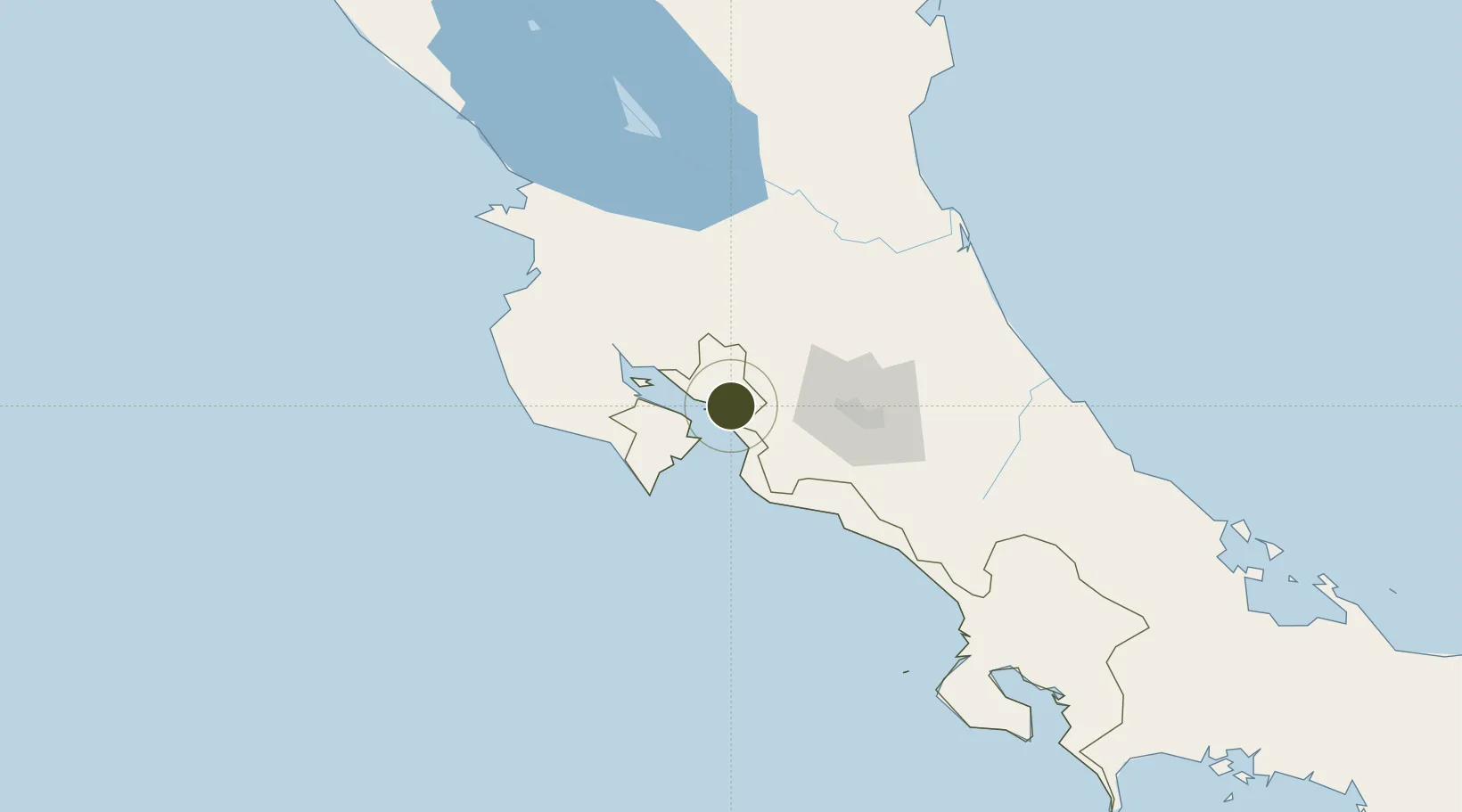
Export Processing Zone · Costa Rica

Zona Franca Puntarenas, SA Active

9.9837°, -84.7207°
40 ha
Zone area
7.5 km
Nearest port
56.1 km
Nearest airport

Gateway access

Nearest neighbours — logibook spatial index (haversine) over the source coordinates

Zone profile

Zone type
Export Processing Zone
Open Zone Map
Region
Puntarenas
Open Zone Map
Status
Active
Open Zone Map
Management
Private
Open Zone Map
Operator
Grupo Saret
Open Zone Map
Legal framework
Free Zone Regime Act No 7210, Act No 8794 and its Bylaws
Open Zone Map

Location

Location of ozm-1691
Natural Earth 10m (public domain) · Puntarenas · ozm-1691 · 9.98, -84.72GoogleOSMYandex

Nearby Logistics Neighbours

Ports
  1. 1Puerto Caldera8 km
  2. 2Puntarenas12 km
  3. 3Puerto Quepos86 km
  4. 4Puerto Moin179 km
  5. 5Puerto Limon187 km
Nearest neighbours — logibook spatial index (haversine) over the source coordinates
Airports
  1. 1Juan Santamaría International Airport56 km
  2. 2La Fortuna Arenal Airport56 km
  3. 3Tobías Bolaños International Airport64 km
  4. 4Quepos Managua Airport88 km
  5. 5Nosara Airport102 km
Nearest neighbours — logibook spatial index (haversine) over the source coordinates
Cities
  1. 1Barranca0 km
  2. 2Puerto Caldera4 km
  3. 3Esparza6 km
  4. 4Salinas7 km
  5. 5Puntarenas13 km
Nearest neighbours — logibook spatial index (haversine) over the source coordinates
Trade Zones
  1. 1Puntarenas Free Trade Zone10 km
  2. 2Activa Industrial Park42 km
  3. 3AAA Top Talent Free Trade Zone44 km
  4. 4Coyol Free Zone49 km
  5. 5Zona Franca BES (BES Free Zone)51 km
Nearest neighbours — logibook spatial index (haversine) over the source coordinates
DatabookThe Record of Consolidated Knowledge
Costa Rica beyond logistics?
Browse databook

All Sources

Trade ZonesOpen Zone Map
CC BY
Portsthe NGA World Port Index
Public domain (US gov)
AirportsOurAirports
Public domain
LocationsUN/LOCODE
UN/LOCODE — free
← Costa Rica trade zones