UN/LOCODE hub · China
CNJIS

Jiangshan Pt

21.6333°, 108.2667°
1
Transport functions

Transport Functions

Port
UN/LOCODE

Hub Profile

Region
GX
GeoNames

Location

Location of CNJIS
Natural Earth 10m (public domain) · GX · CNJIS · 21.63, 108.27GoogleOSMYandex

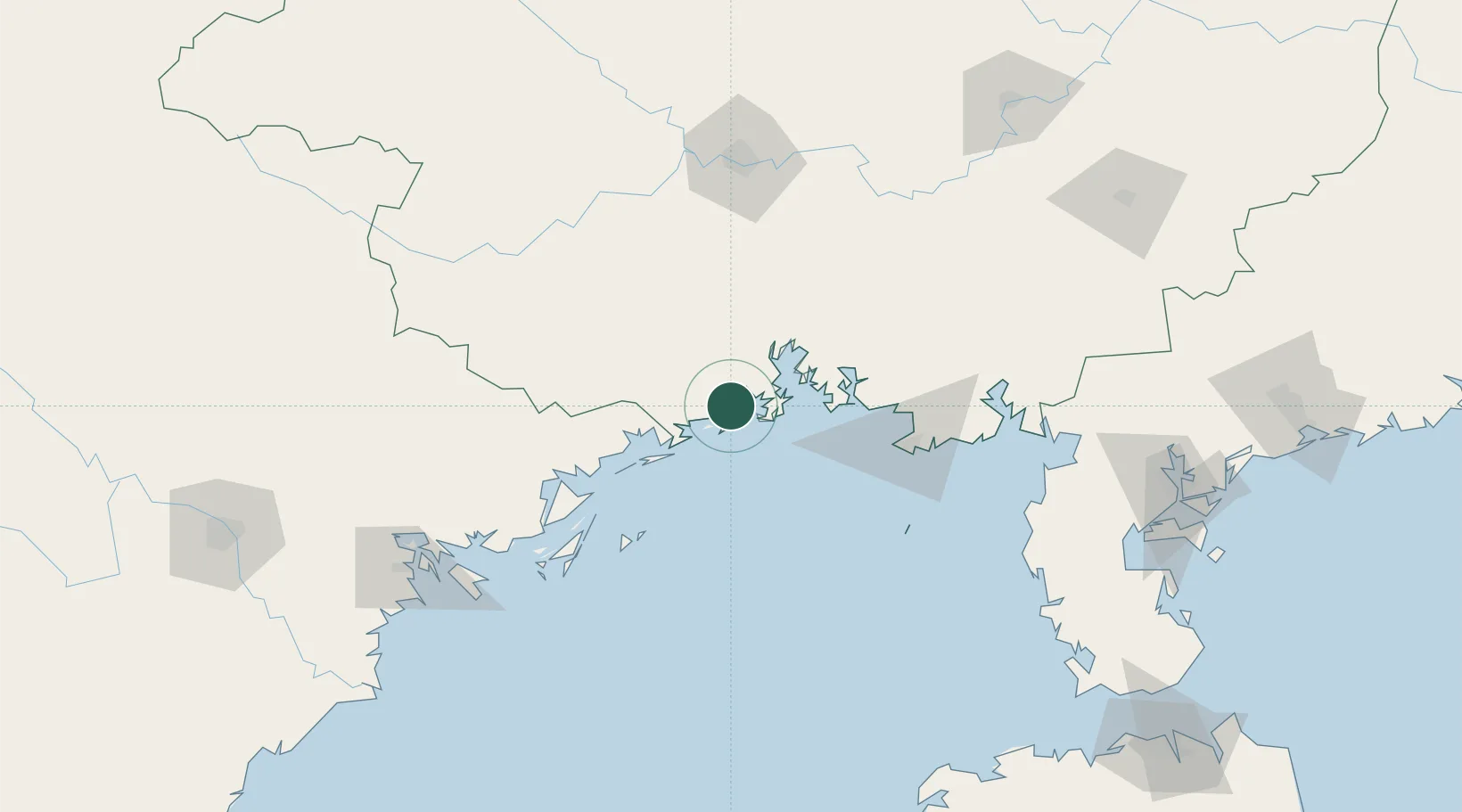
Nearby Logistics Neighbours

Cities
  1. 1Fangcheng Pt8 km
  2. 2Qisha Pt21 km
  3. 3Dongxing34 km
  4. 4Beihai Pt90 km
  5. 5Beihai99 km
Nearest neighbours — logibook spatial index (haversine) over the source coordinates
Ports
  1. 1Fang-Cheng16 km
  2. 2Qinzhou35 km
  3. 3Beihai84 km
  4. 4Cam Pha115 km
  5. 5Hon Gai146 km
Nearest neighbours — logibook spatial index (haversine) over the source coordinates
Airports
  1. 1Van Don International Airport105 km
  2. 2Beihai Fucheng Airport107 km
  3. 3Nanning Wuxu International Airport108 km
  4. 4Baihe Ningming Air Base130 km
  5. 5Cat Bi International Airport184 km
Nearest neighbours — logibook spatial index (haversine) over the source coordinates
Trade Zones
  1. 1Fangcheng Industrial Park23 km
  2. 2Qinzhou Port Economic Development Zone37 km
  3. 3Qinbei District Economic and Technological Development Zone60 km
  4. 4Hải Hà Seaport Industrial Park62 km
  5. 5Beihai Export Processing Zone87 km
Nearest neighbours — logibook spatial index (haversine) over the source coordinates
DatabookThe Record of Consolidated Knowledge
China beyond logistics?
Browse databook

All Sources

LocationsUN/LOCODE
UN/LOCODE — free
Portsthe NGA World Port Index
Public domain (US gov)
AirportsOurAirports
Public domain
Trade Zonesthe World Bank SEZ database
CC BY 4.0
Trade ZonesOpen Zone Map
CC BY
← China locations