UN/LOCODE hub · Côte d’Ivoire
CIESP

Espoir

5.0667°, -4.3833°
1
Transport functions

Transport Functions

Port
Espoir is also a profiled seaport →
UN/LOCODE

Location

Location of CIESP
Natural Earth 10m (public domain) · CIESP · 5.07, -4.38GoogleOSMYandex

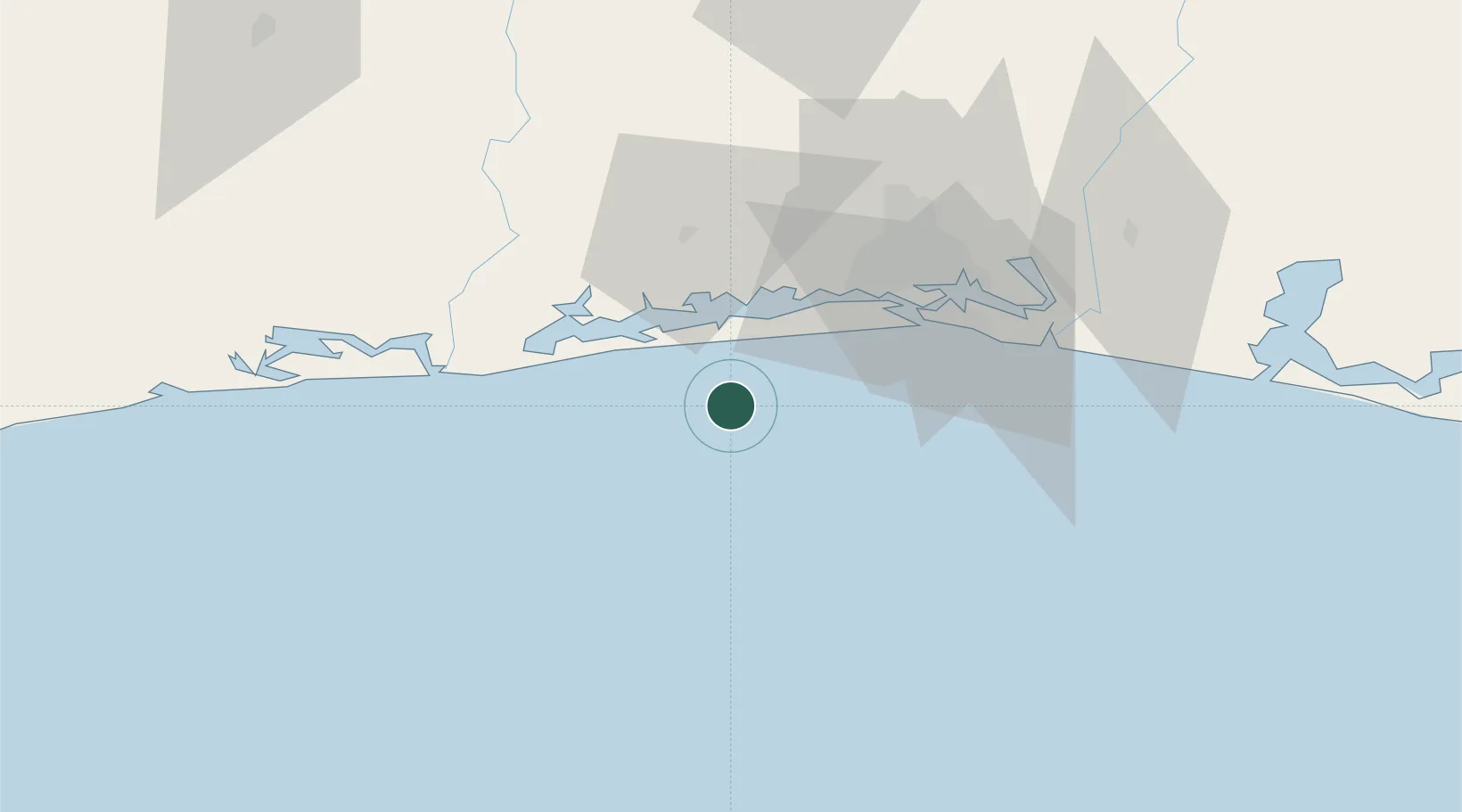
Nearby Logistics Neighbours

Cities
  1. 1Jacqueville15 km
  2. 2Baobab Terminal23 km
  3. 3Dabou28 km
  4. 4Abidjan48 km
  5. 5Vridi49 km
Nearest neighbours — logibook spatial index (haversine) over the source coordinates
Ports
  1. 1Baobab Marine Terminal22 km
  2. 2Abidjan45 km
  3. 3Port Bouet50 km
  4. 4San Pedro250 km
  5. 5Takoradi294 km
Nearest neighbours — logibook spatial index (haversine) over the source coordinates
Airports
  1. 1Félix-Houphouët-Boigny International Airport55 km
  2. 2Yamoussoukro International Airport231 km
  3. 3San Pedro Airport255 km
  4. 4Takoradi Airport290 km
  5. 5Daloa Airport300 km
Nearest neighbours — logibook spatial index (haversine) over the source coordinates
Trade Zones
  1. 1PK 24 Industrial Park46 km
  2. 2Vridi Industrial Park48 km
  3. 3Koumassi Industrial Park54 km
  4. 4Mahatma Ghandi Free Trade Zone72 km
  5. 5Bonoua Industrial Park93 km
Nearest neighbours — logibook spatial index (haversine) over the source coordinates
DatabookThe Record of Consolidated Knowledge
Côte d’Ivoire beyond logistics?
Browse databook

All Sources

LocationsUN/LOCODE
UN/LOCODE — free
Portsthe NGA World Port Index
Public domain (US gov)
AirportsOurAirports
Public domain
Trade Zonesthe World Bank SEZ database
CC BY 4.0
Trade ZonesOpen Zone Map
CC BY
← Côte d’Ivoire locations