Diversified Zone · Côte d’Ivoire

Koumassi Industrial Park Active
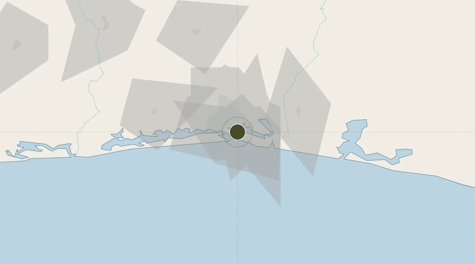
5.2882°, -3.9480°
127 ha
Zone area
6.4 km
Nearest port
3.8 km
Nearest airport

Gateway access

Nearest neighbours — logibook spatial index (haversine) over the source coordinates

Zone profile

Zone type
Diversified Zone
Open Zone Map
Region
Lagunes
Open Zone Map
Status
Active
Open Zone Map
Management
Public
Open Zone Map
Operator
Agency for the Management and Development of Industrial Infrastructure, National Fund for the Development of Industrial Zones
Open Zone Map
Legal framework
Law No. 2004-429 of 30 August 2004
Open Zone Map

Location

Location of ozm-1711
Natural Earth 10m (public domain) · Lagunes · ozm-1711 · 5.29, -3.95GoogleOSMYandex

Nearby Logistics Neighbours

Ports
  1. 1Port Bouet6 km
  2. 2Abidjan9 km
  3. 3Espoir Marine Terminal62 km
  4. 4Baobab Marine Terminal76 km
  5. 5Takoradi249 km
Nearest neighbours — logibook spatial index (haversine) over the source coordinates
Airports
  1. 1Félix-Houphouët-Boigny International Airport4 km
  2. 2Yamoussoukro International Airport238 km
  3. 3Takoradi Airport245 km
  4. 4Sunyani Airport292 km
  5. 5Bouaké Airport300 km
Nearest neighbours — logibook spatial index (haversine) over the source coordinates
Cities
  1. 1Port-Bouët5 km
  2. 2Vridi6 km
  3. 3Cocody9 km
  4. 4Abidjan11 km
  5. 5Dabou47 km
Nearest neighbours — logibook spatial index (haversine) over the source coordinates
Trade Zones
  1. 1Vridi Industrial Park6 km
  2. 2Mahatma Ghandi Free Trade Zone22 km
  3. 3PK 24 Industrial Park27 km
  4. 4Bonoua Industrial Park42 km
  5. 5Yamoussoukro Industrial Park223 km
Nearest neighbours — logibook spatial index (haversine) over the source coordinates
DatabookThe Record of Consolidated Knowledge
Côte d’Ivoire beyond logistics?
Browse databook

All Sources

Trade ZonesOpen Zone Map
CC BY
Portsthe NGA World Port Index
Public domain (US gov)
AirportsOurAirports
Public domain
LocationsUN/LOCODE
UN/LOCODE — free
← Côte d’Ivoire trade zones