UN/LOCODE hub · Côte d’Ivoire
CIBAO

Baobab Terminal

4.9500°, -4.5500°
2
Transport functions

Transport Functions

Port
Road
Baobab Terminal is also a profiled seaport →
UN/LOCODE

Location

Location of CIBAO
Natural Earth 10m (public domain) · CIBAO · 4.95, -4.55GoogleOSMYandex

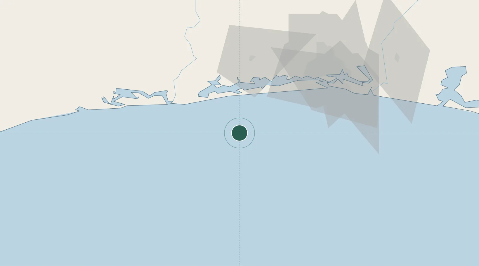
Nearby Logistics Neighbours

Cities
  1. 1Espoir23 km
  2. 2Jacqueville32 km
  3. 3Dabou46 km
  4. 4Grand Lahou56 km
  5. 5Abidjan71 km
Nearest neighbours — logibook spatial index (haversine) over the source coordinates
Ports
  1. 1Espoir Marine Terminal16 km
  2. 2Abidjan68 km
  3. 3Port Bouet72 km
  4. 4San Pedro230 km
  5. 5Takoradi312 km
Nearest neighbours — logibook spatial index (haversine) over the source coordinates
Airports
  1. 1Félix-Houphouët-Boigny International Airport77 km
  2. 2San Pedro Airport235 km
  3. 3Yamoussoukro International Airport235 km
  4. 4Daloa Airport295 km
  5. 5Takoradi Airport308 km
Nearest neighbours — logibook spatial index (haversine) over the source coordinates
Trade Zones
  1. 1PK 24 Industrial Park67 km
  2. 2Vridi Industrial Park70 km
  3. 3Koumassi Industrial Park77 km
  4. 4Mahatma Ghandi Free Trade Zone93 km
  5. 5Bonoua Industrial Park115 km
Nearest neighbours — logibook spatial index (haversine) over the source coordinates
DatabookThe Record of Consolidated Knowledge
Côte d’Ivoire beyond logistics?
Browse databook

All Sources

LocationsUN/LOCODE
UN/LOCODE — free
Portsthe NGA World Port Index
Public domain (US gov)
AirportsOurAirports
Public domain
Trade Zonesthe World Bank SEZ database
CC BY 4.0
Trade ZonesOpen Zone Map
CC BY
← Côte d’Ivoire locations