UN/LOCODE hub · Canada
CAVCH

Verchères

45.7667°, -73.3500°
4,030
Population
1
Transport functions

Transport Functions

Port
UN/LOCODE

Hub Profile

Place type
Populated place
GeoNames
Region
Quebec
GeoNames
Population
4,030
GeoNames
Time zone
America/Toronto
GeoNames
Elevation
2 m
GeoNames

Location

Location of CAVCH
Natural Earth 10m (public domain) · Quebec · CAVCH · 45.77, -73.35GoogleOSMYandex

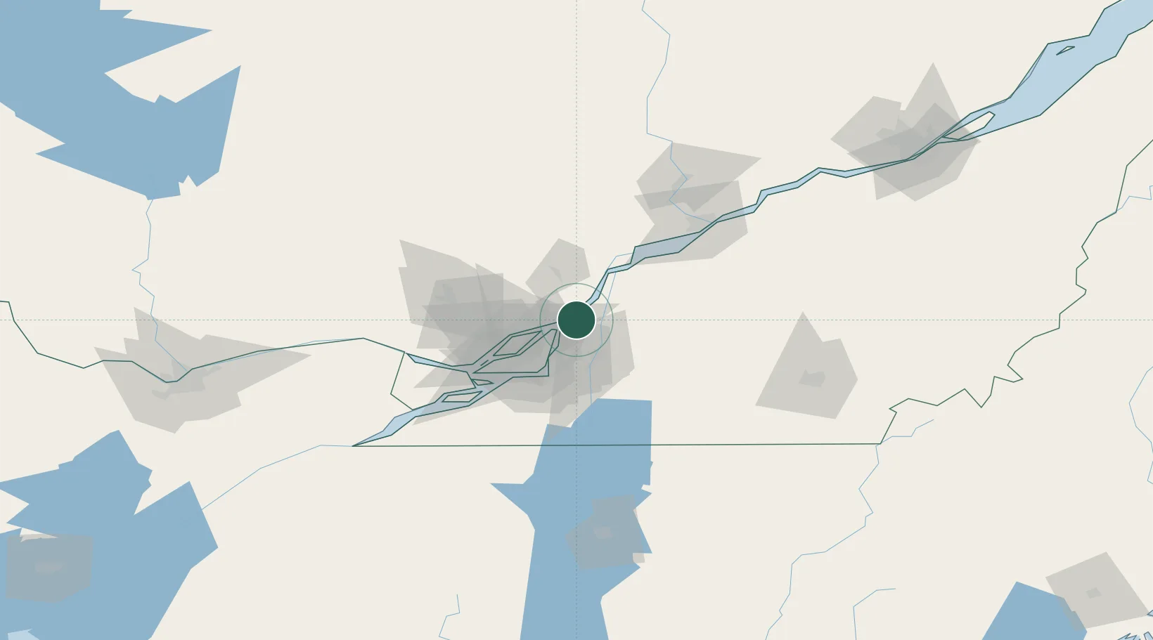
Nearby Logistics Neighbours

Cities
  1. 1Saint-Charles-sur-Richelieu16 km
  2. 2Pointe-aux-Trembles17 km
  3. 3Montréal-Est19 km
  4. 4Saint-Roch-de-l'Achigan20 km
  5. 5Terrebonne22 km
Nearest neighbours — logibook spatial index (haversine) over the source coordinates
Ports
  1. 1Contrecour17 km
  2. 2Montreal32 km
  3. 3Sorel36 km
  4. 4Beauharnois65 km
  5. 5Oka Sur Le Lac66 km
Nearest neighbours — logibook spatial index (haversine) over the source coordinates
Trade Zones
  1. 1Greater Montreal Free Zone Center33 km
  2. 2Québec City FTZ200 km
  3. 3FTZ No. 118 Ogdensburg206 km
  4. 4FTZ No. 109 Watertown282 km
  5. 5FTZ No. 263 Auburn309 km
Nearest neighbours — logibook spatial index (haversine) over the source coordinates
DatabookThe Record of Consolidated Knowledge
Canada beyond logistics?
Browse databook

All Sources

LocationsUN/LOCODE
UN/LOCODE — free
LocationsGeoNames
CC BY 4.0
Portsthe NGA World Port Index
Public domain (US gov)
AirportsOurAirports
Public domain
Trade Zonesthe World Bank SEZ database
CC BY 4.0
Trade ZonesOpen Zone Map
CC BY
← Canada locations