UN/LOCODE hub · Brazil
BRSAO

São Paulo

-23.9745°, -46.2807°
4
Transport functions

Transport Functions

Rail
Road
Multimodal
Postal
UN/LOCODE

Hub Profile

Place type
Populated place
GeoNames
Region
São Paulo
GeoNames
Time zone
America/Sao_Paulo
GeoNames
Elevation
782 m
GeoNames
Logistics facilities
4
UN/LOCODE

Location

Location of BRSAO
Natural Earth 10m (public domain) · São Paulo · BRSAO · -23.97, -46.28GoogleOSMYandex

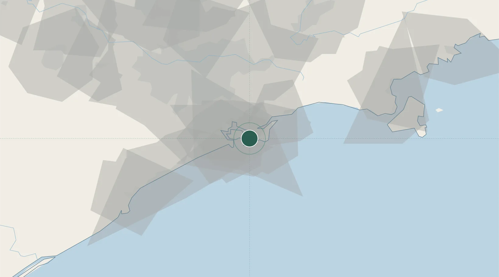
Nearby Logistics Neighbours

Cities
  1. 1Gurupi3 km
  2. 2Guarujá6 km
  3. 3Santos9 km
  4. 4São Vicente15 km
  5. 5Cubatão17 km
Nearest neighbours — logibook spatial index (haversine) over the source coordinates
Ports
  1. 1Santos3 km
  2. 2Sao Sebastiao92 km
  3. 3Angra Dos Reis227 km
  4. 4Paranagua282 km
  5. 5Rio De Janeiro339 km
Nearest neighbours — logibook spatial index (haversine) over the source coordinates
Trade Zones
  1. 1ZPE de Itaguaí (RJ)282 km
  2. 2ZPE de Imbituba (SC)464 km
  3. 3ZPE de Uberaba (MG)507 km
  4. 4ZPE de Fernandópolis (SP)580 km
  5. 5ZPE do Açú (RJ)587 km
Nearest neighbours — logibook spatial index (haversine) over the source coordinates
DatabookThe Record of Consolidated Knowledge
Brazil beyond logistics?
Browse databook

All Sources

LocationsUN/LOCODE
UN/LOCODE — free
Portsthe NGA World Port Index
Public domain (US gov)
AirportsOurAirports
Public domain
Trade Zonesthe World Bank SEZ database
CC BY 4.0
Trade ZonesOpen Zone Map
CC BY
← Brazil locations