UN/LOCODE hub · Antarctica
AQKSG

King Sejong

-62.2167°, -58.7833°
1
Transport functions

Transport Functions

Port
UN/LOCODE

Location

Location of AQKSG
Natural Earth 10m (public domain) · AQKSG · -62.22, -58.78GoogleOSMYandex

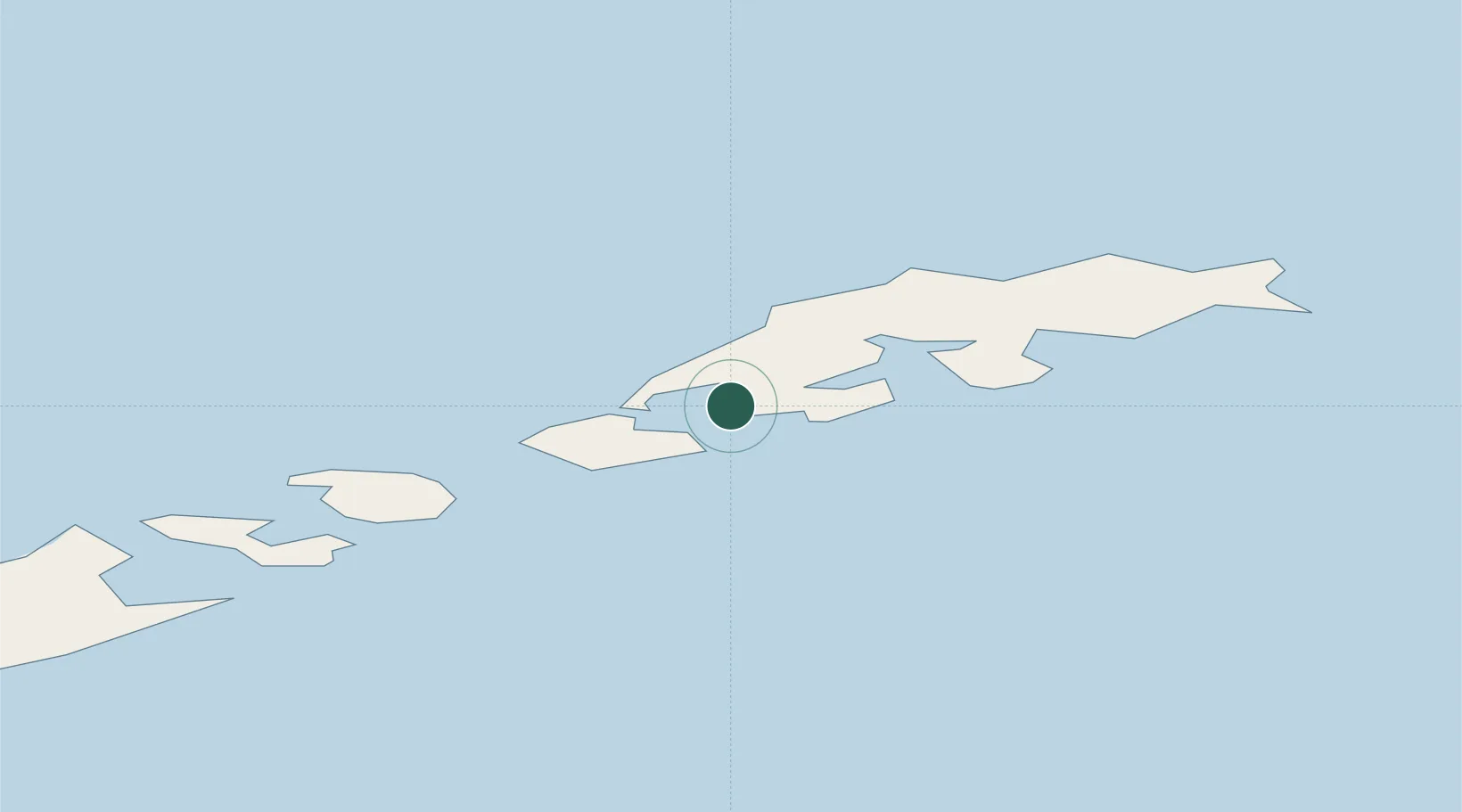
Nearby Logistics Neighbours

Cities
  1. 1Artigas7 km
  2. 2Jubany7 km
  3. 3Escudero9 km
  4. 4Bellingshausen9 km
  5. 5Great Wall10 km
Nearest neighbours — logibook spatial index (haversine) over the source coordinates
Ports
  1. 1Port Foster125 km
  2. 2Puerto Williams956 km
  3. 3Ushuaia989 km
  4. 4Rio Grande1072 km
  5. 5San Sebastian Bay1157 km
Nearest neighbours — logibook spatial index (haversine) over the source coordinates
Trade Zones
  1. 1Tierra del Fuego ProvInce Special Customs Area (SCA)990 km
  2. 2Punta Arenas Free Trade Zone1235 km
  3. 3La Zona Franca Santa Cruz (ZFSC) - Río Gallegos1326 km
  4. 4La Zona Franca Santa Cruz (ZFSC) - Caleta Olivia1836 km
  5. 5Comodoro Free Trade Zone1899 km
Nearest neighbours — logibook spatial index (haversine) over the source coordinates
DatabookThe Record of Consolidated Knowledge
Antarctica beyond logistics?
Browse databook

All Sources

LocationsUN/LOCODE
UN/LOCODE — free
Portsthe NGA World Port Index
Public domain (US gov)
AirportsOurAirports
Public domain
Trade Zonesthe World Bank SEZ database
CC BY 4.0
Trade ZonesOpen Zone Map
CC BY
← Antarctica locations