Diversified Zone · Vietnam

Dien Nam - Dien Ngoc Industrial Zone Active

15.9382°, 108.2627°
418 ha
Zone area
18.7 km
Nearest port
13.6 km
Nearest airport

Gateway access

Nearest neighbours — logibook spatial index (haversine) over the source coordinates

Zone profile

Zone type
Diversified Zone
Open Zone Map
Region
Quàng Nam
Open Zone Map
Status
Active
Open Zone Map
Management
Public
Open Zone Map
Operator
Quang Nam - Da Nang Industrial park & Urban Development Company
Open Zone Map
Legal framework
Decree No.82/2018/ND-CP on Management of Industrial Parks and Economic Zones, Decree No 218/2013/ND-CP
Open Zone Map

Location

Location of ozm-5038
Natural Earth 10m (public domain) · Quàng Nam · ozm-5038 · 15.94, 108.26GoogleOSMYandex

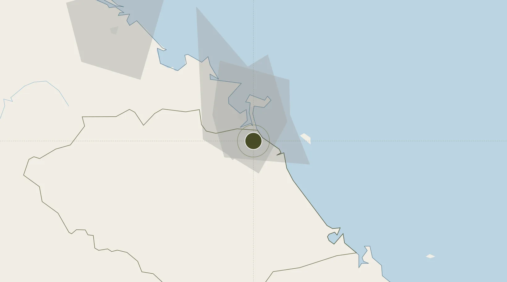
Nearby Logistics Neighbours

Ports
  1. 1Da Nang19 km
  2. 2Qui Nhon263 km
  3. 3Sanya293 km
  4. 4Basuo354 km
  5. 5Nghe Tinh411 km
Nearest neighbours — logibook spatial index (haversine) over the source coordinates
Airports
  1. 1Da Nang International Airport14 km
  2. 2Chu Lai Airport76 km
  3. 3Phu Bai International Airport79 km
  4. 4Pleiku Airport217 km
  5. 5Phu Cat Airport236 km
Nearest neighbours — logibook spatial index (haversine) over the source coordinates
Cities
  1. 1Nguyen Van Troi Port13 km
  2. 2Song Han 913 km
  3. 3Hoa Vang16 km
  4. 4Da Nang18 km
  5. 5Hai Son18 km
Nearest neighbours — logibook spatial index (haversine) over the source coordinates
Trade Zones
  1. 1Hoa Cam Industrial Park12 km
  2. 2Đà Nẵng Hi-Tech Park16 km
  3. 3Đà Nẵng (An Don) Industrial Zone16 km
  4. 4Đại Hiệp Industrial Zone17 km
  5. 5Đà Nẵng Seafood Service Industrial Zone18 km
Nearest neighbours — logibook spatial index (haversine) over the source coordinates
DatabookThe Record of Consolidated Knowledge
Vietnam beyond logistics?
Browse databook

All Sources

Trade ZonesOpen Zone Map
CC BY
Portsthe NGA World Port Index
Public domain (US gov)
AirportsOurAirports
Public domain
LocationsUN/LOCODE
UN/LOCODE — free
← Vietnam trade zones