Industrial Zone · Vietnam

Hoa Cam Industrial Park Active
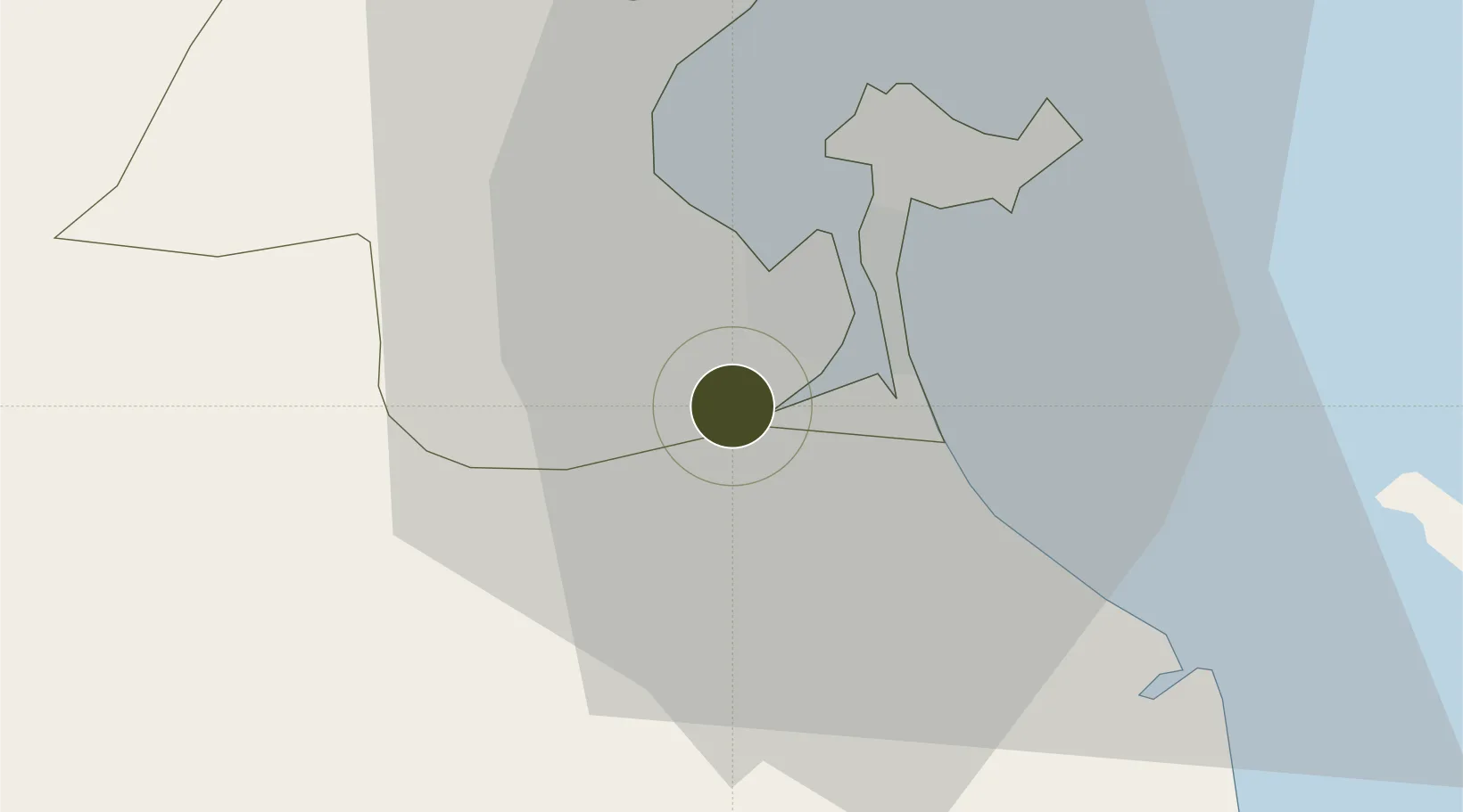
16.0074°, 108.1805°
136 ha
Zone area
11.0 km
Nearest port
4.5 km
Nearest airport

Gateway access

Nearest neighbours — logibook spatial index (haversine) over the source coordinates

Zone profile

Zone type
Industrial Zone
the World Bank SEZ database
Region
Đà Nẵng
the World Bank SEZ database
Status
Active
the World Bank SEZ database
Established
2003
the World Bank SEZ database
Management
Private management
the World Bank SEZ database
Operator
Hoa Cam Industrial park Investment JSC
the World Bank SEZ database
Regulatory authority
Chairmen of Provincial People's Committees
the World Bank SEZ database
Legal framework
Law on Foreign Investment in Vietnam, 1996; Decree No. 36/1997/CP on The Regulation of Industrial, Economic and Export processing zones
the World Bank SEZ database

Location

Location of VNM38
Natural Earth 10m (public domain) · Đà Nẵng · VNM38 · 16.01, 108.18GoogleOSMYandex

Fiscal & incentives

Corporate tax
20%
the World Bank SEZ database
Tax relief
100% exempt
the World Bank SEZ database
Relief duration
4 years
the World Bank SEZ database
VAT
No exemption
the World Bank SEZ database
Import duty (inputs)
0% exempt
the World Bank SEZ database
Import duty (capex)
100% exempt
the World Bank SEZ database
Profit repatriation
No exemption
the World Bank SEZ database
Capital gains
No exemption
the World Bank SEZ database
Withholding tax
No exemption
the World Bank SEZ database
Min. investment
None
the World Bank SEZ database
Min. export
0%
the World Bank SEZ database
Employment incentive
No exemption
the World Bank SEZ database
Developer incentive
No established framework
the World Bank SEZ database

Nearby Logistics Neighbours

Ports
  1. 1Da Nang11 km
  2. 2Qui Nhon274 km
  3. 3Sanya290 km
  4. 4Basuo347 km
  5. 5Nghe Tinh400 km
Nearest neighbours — logibook spatial index (haversine) over the source coordinates
Airports
  1. 1Da Nang International Airport5 km
  2. 2Phu Bai International Airport67 km
  3. 3Chu Lai Airport88 km
  4. 4Pleiku Airport223 km
  5. 5Dong Hoi Airport238 km
Nearest neighbours — logibook spatial index (haversine) over the source coordinates
Cities
  1. 1Nguyen Van Troi Port6 km
  2. 2Song Han 96 km
  3. 3Da Nang12 km
  4. 4Hai Son12 km
  5. 5Tien Sa Terminal12 km
Nearest neighbours — logibook spatial index (haversine) over the source coordinates
Trade Zones
  1. 1Đà Nẵng Hi-Tech Park5 km
  2. 2Đà Nẵng (An Don) Industrial Zone10 km
  3. 3Hoa Khanh Industrial Park10 km
  4. 4Da Nang Hi-Tech Park10 km
  5. 5Hoa Khanh Expanded Industrial Park11 km
Nearest neighbours — logibook spatial index (haversine) over the source coordinates
DatabookThe Record of Consolidated Knowledge
Vietnam beyond logistics?
Browse databook

All Sources

Trade Zonesthe World Bank SEZ database
CC BY 4.0
Portsthe NGA World Port Index
Public domain (US gov)
AirportsOurAirports
Public domain
LocationsUN/LOCODE
UN/LOCODE — free
← Vietnam trade zones