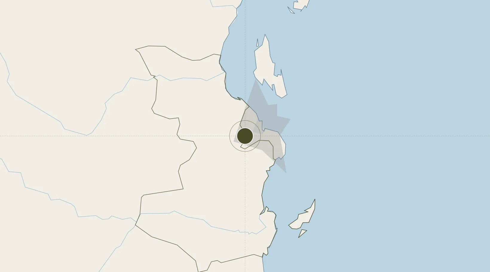
Export Processing Zone · Tanzania

Vigor Special Economic Zone Under Development

-6.9046°, 39.0802°
2,600 ha
Zone area
26.2 km
Nearest port
14.4 km
Nearest airport

Gateway access

Nearest neighbours — logibook spatial index (haversine) over the source coordinates

Zone profile

Zone type
Export Processing Zone
Open Zone Map
Region
Pwani
Open Zone Map
Status
Under Development
Open Zone Map
Management
Public-Private Partnership
Open Zone Map
Operator
Tanzania Port Authority
Open Zone Map
Legal framework
Special Economic Zones Act of 2006
Open Zone Map

Location

Location of ozm-4429
Natural Earth 10m (public domain) · Pwani · ozm-4429 · -6.90, 39.08GoogleOSMYandex

Nearby Logistics Neighbours

Ports
  1. 1Dar Es Salaam26 km
  2. 2Zanzibar83 km
  3. 3Tanga203 km
  4. 4Kilwa Kivinje207 km
  5. 5Mombasa322 km
Nearest neighbours — logibook spatial index (haversine) over the source coordinates
Airports
  1. 1Julius Nyerere International Airport14 km
  2. 2Abeid Amani Karume International Airport78 km
  3. 3Mafia Airport130 km
  4. 4Pemba Airport200 km
  5. 5Tanga Airport202 km
Nearest neighbours — logibook spatial index (haversine) over the source coordinates
Cities
  1. 1African Inland Container Depot19 km
  2. 2Dar es Salaam21 km
  3. 3Kibaha24 km
  4. 4Zanzibar84 km
  5. 5Ikwiriri120 km
Nearest neighbours — logibook spatial index (haversine) over the source coordinates
Trade Zones
  1. 1Visegese Industrial Park2 km
  2. 2Benjamin Mkapa Special Economic Zone18 km
  3. 3Hidafhi Export Processing Zone19 km
  4. 4Millenium Business Park Export Processing Zone19 km
  5. 5Kibaha Textile Special Economic Zone20 km
Nearest neighbours — logibook spatial index (haversine) over the source coordinates
DatabookThe Record of Consolidated Knowledge
Tanzania beyond logistics?
Browse databook

All Sources

Trade ZonesOpen Zone Map
CC BY
Portsthe NGA World Port Index
Public domain (US gov)
AirportsOurAirports
Public domain
LocationsUN/LOCODE
UN/LOCODE — free
← Tanzania trade zones