UN/LOCODE hub · Türkiye
TRUZE

Antalya Free Zone

36.8333°, 30.6000°
1
Transport functions

Transport Functions

Multimodal
Antalya Free Zone is also a profiled seaport →
UN/LOCODE

Hub Profile

Region
07
GeoNames

Location

Location of TRUZE
Natural Earth 10m (public domain) · 07 · TRUZE · 36.83, 30.60GoogleOSMYandex

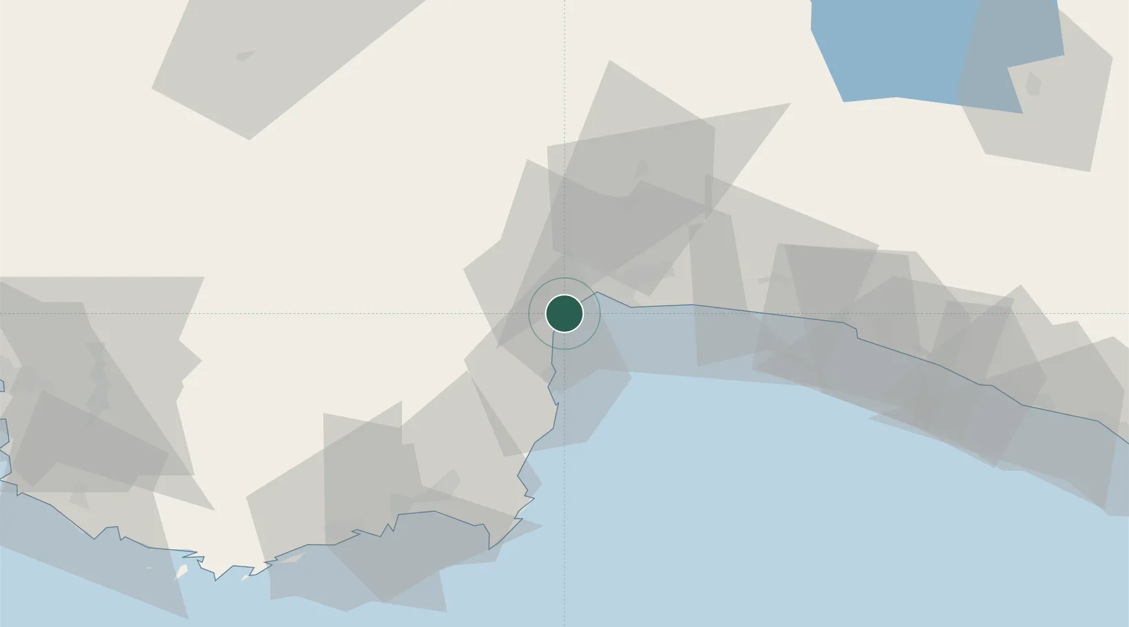
Nearby Logistics Neighbours

Cities
  1. 1Antalya1 km
  2. 2Dosemealti20 km
  3. 3Kemer28 km
  4. 4Finike74 km
  5. 5Manavgat76 km
Nearest neighbours — logibook spatial index (haversine) over the source coordinates
Ports
  1. 1Antalya2 km
  2. 2Alanya129 km
  3. 3Fethiye136 km
  4. 4Marmaris206 km
  5. 5Rodhos215 km
Nearest neighbours — logibook spatial index (haversine) over the source coordinates
Airports
  1. 1Antalya International Airport19 km
  2. 2Süleyman Demirel International Airport116 km
  3. 3Kastelorizo Airport120 km
  4. 4Çardak Airport132 km
  5. 5Dalaman International Airport162 km
Nearest neighbours — logibook spatial index (haversine) over the source coordinates
Trade Zones
  1. 1Antalya Free Zone1 km
  2. 2Antalya Organized Industrial Zone27 km
  3. 3Denizli Free Zone136 km
  4. 4Afyonkarahisar Organized Industrial Zone218 km
  5. 5Usak Deri (Karma) Organized Industrial Zone222 km
Nearest neighbours — logibook spatial index (haversine) over the source coordinates
DatabookThe Record of Consolidated Knowledge
Türkiye beyond logistics?
Browse databook

All Sources

LocationsUN/LOCODE
UN/LOCODE — free
Portsthe NGA World Port Index
Public domain (US gov)
AirportsOurAirports
Public domain
Trade Zonesthe World Bank SEZ database
CC BY 4.0
Trade ZonesOpen Zone Map
CC BY
← Türkiye locations