UN/LOCODE hub · Türkiye
TRIDM

Isdemir

36.7167°, 36.1833°
1
Transport functions

Transport Functions

Port
UN/LOCODE

Hub Profile

Region
31
GeoNames

Location

Location of TRIDM
Natural Earth 10m (public domain) · 31 · TRIDM · 36.72, 36.18GoogleOSMYandex

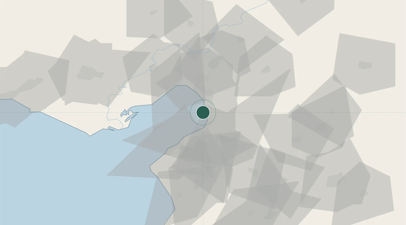
Nearby Logistics Neighbours

Cities
  1. 1Sariseki6 km
  2. 2Iskenderun10 km
  3. 3Botas11 km
  4. 4Dörtyol17 km
  5. 5Toros Gubre Terminal, Gubre29 km
Nearest neighbours — logibook spatial index (haversine) over the source coordinates
Ports
  1. 1Yakacik0 km
  2. 2Iskenderun13 km
  3. 3Botas29 km
  4. 4Toros Gubre29 km
  5. 5Al Ladhiqiyah137 km
Nearest neighbours — logibook spatial index (haversine) over the source coordinates
Airports
  1. 1Hatay Airport40 km
  2. 2İncirlik Air Base75 km
  3. 3Adana Şakirpaşa Airport86 km
  4. 4Çukurova International Airport101 km
  5. 5Aleppo International Airport111 km
Nearest neighbours — logibook spatial index (haversine) over the source coordinates
Trade Zones
  1. 1Iskenderun Organized Industrial Zone4 km
  2. 2Adana Yumurtalik Free Zone28 km
  3. 3Osmaniye Organized Industrial Zone34 km
  4. 4Adana Haci Sabanci Organized Industrial Zone59 km
  5. 5Aleppo Free Zone106 km
Nearest neighbours — logibook spatial index (haversine) over the source coordinates
DatabookThe Record of Consolidated Knowledge
Türkiye beyond logistics?
Browse databook

All Sources

LocationsUN/LOCODE
UN/LOCODE — free
Portsthe NGA World Port Index
Public domain (US gov)
AirportsOurAirports
Public domain
Trade Zonesthe World Bank SEZ database
CC BY 4.0
Trade ZonesOpen Zone Map
CC BY
← Türkiye locations