UN/LOCODE hub · Tunisia
TNTZC

El Jem

35.3000°, 10.7167°
21,544
Population
1
Transport functions

Transport Functions

Multimodal
UN/LOCODE

Hub Profile

Place type
Populated place
GeoNames
Region
Mahdia Governorate
GeoNames
Population
21,544
GeoNames
Time zone
Africa/Tunis
GeoNames
Elevation
112 m
GeoNames

Location

Location of TNTZC
Natural Earth 10m (public domain) · Mahdia Governorate · TNTZC · 35.30, 10.72GoogleOSMYandex

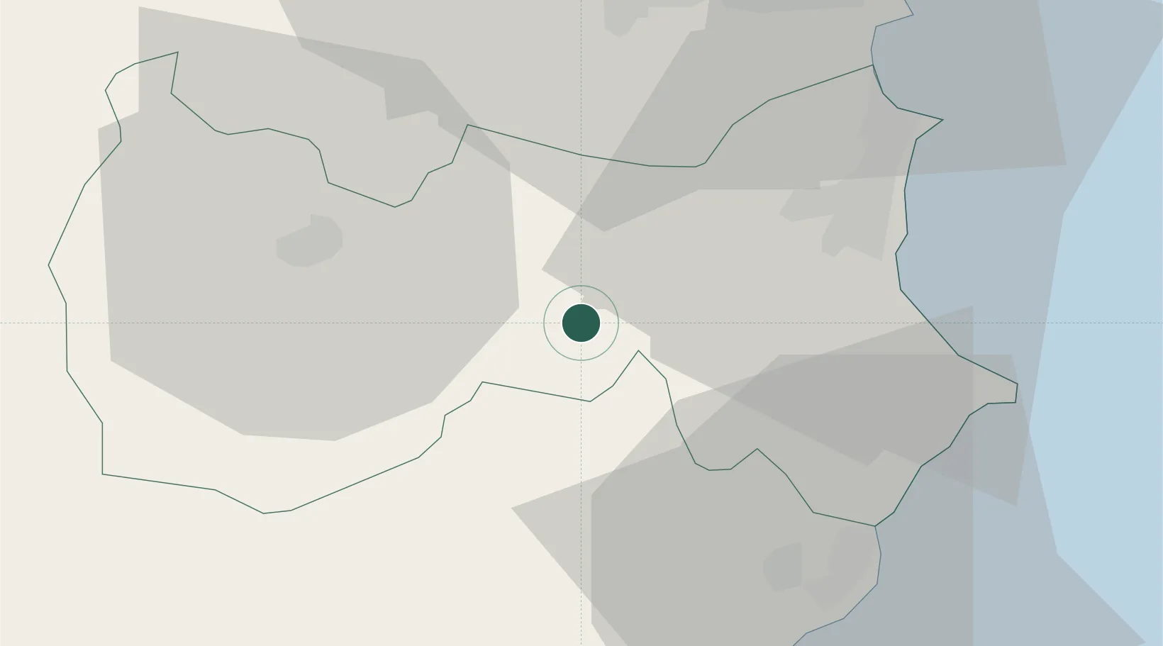
Nearby Logistics Neighbours

Cities
  1. 1Bu Mirdas17 km
  2. 2Chebba36 km
  3. 3Mahdia38 km
  4. 4Ksibet el Médiouni42 km
  5. 5Bu Hajar45 km
Nearest neighbours — logibook spatial index (haversine) over the source coordinates
Ports
  1. 1Mahdia39 km
  2. 2Sousse60 km
  3. 3Mersa Sfax63 km
  4. 4Skhira126 km
  5. 5Ashtart Oil Terminal128 km
Nearest neighbours — logibook spatial index (haversine) over the source coordinates
Airports
  1. 1Monastir Habib Bourguiba International Airport51 km
  2. 2Sfax Thyna International Airport65 km
  3. 3Enfidha - Hammamet International Airport90 km
  4. 4Djerba Zarzis International Airport159 km
  5. 5Lampedusa Airport174 km
Nearest neighbours — logibook spatial index (haversine) over the source coordinates
Trade Zones
  1. 1Zarzis Park of Economic Activities205 km
  2. 2Bizerte Park of Economic Activities232 km
  3. 3Ben Guerdane Economic Free Zone252 km
  4. 4Zwara-Abu-Kemmash Free Trade Zone290 km
  5. 5Taminhent Free Zone331 km
Nearest neighbours — logibook spatial index (haversine) over the source coordinates
DatabookThe Record of Consolidated Knowledge
Tunisia beyond logistics?
Browse databook

All Sources

LocationsUN/LOCODE
UN/LOCODE — free
LocationsGeoNames
CC BY 4.0
Portsthe NGA World Port Index
Public domain (US gov)
AirportsOurAirports
Public domain
Trade Zonesthe World Bank SEZ database
CC BY 4.0
Trade ZonesOpen Zone Map
CC BY
← Tunisia locations