UN/LOCODE hub · Sweden
SENOE

Norrtälje

59.7500°, 18.7167°
1
Transport functions

Transport Functions

Port
UN/LOCODE

Hub Profile

Region
AB
GeoNames

Location

Location of SENOE
Natural Earth 10m (public domain) · AB · SENOE · 59.75, 18.72GoogleOSMYandex

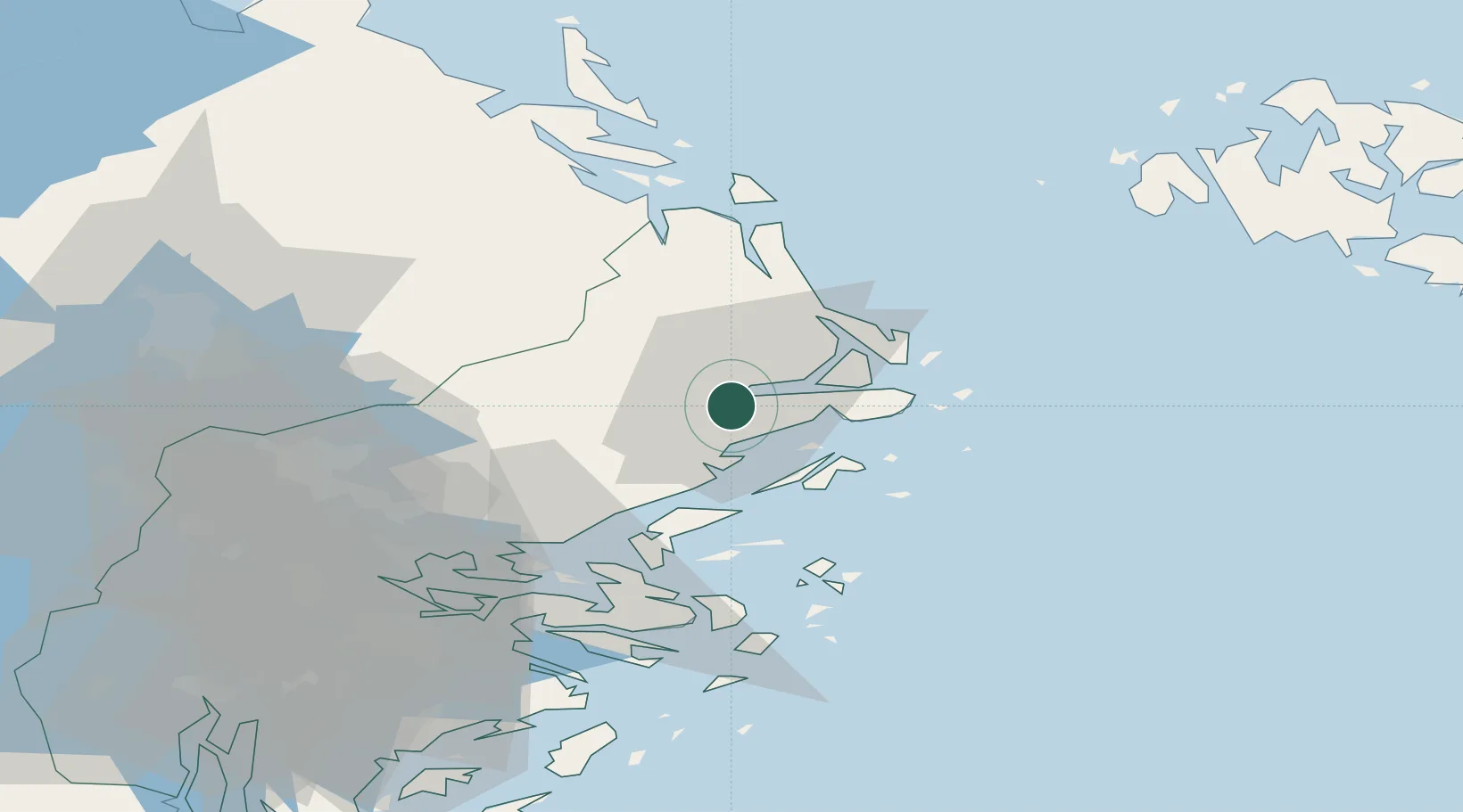
Nearby Logistics Neighbours

Cities
  1. 1Kapellskär20 km
  2. 2Linanäs23 km
  3. 3Hallstavik34 km
  4. 4Grisslehamn40 km
  5. 5Vaxholm45 km
Nearest neighbours — logibook spatial index (haversine) over the source coordinates
Ports
  1. 1Hallstavik34 km
  2. 2Grisslehamn39 km
  3. 3Hargshamn50 km
  4. 4Gustavsberg52 km
  5. 5Stockholm60 km
Nearest neighbours — logibook spatial index (haversine) over the source coordinates
Airports
  1. 1Stockholm-Arlanda Airport46 km
  2. 2Stockholm-Bromma Airport62 km
  3. 3Mariehamn Airport78 km
  4. 4Stockholm Västerås Airport118 km
  5. 5Eskilstuna Airport122 km
Nearest neighbours — logibook spatial index (haversine) over the source coordinates
Trade Zones
  1. 1Stockholm Free Zone56 km
  2. 2Turku Free Zone209 km
  3. 3Freeport of Hanko233 km
  4. 4Free port of Ventspils308 km
  5. 5Jönköping Free Zone346 km
Nearest neighbours — logibook spatial index (haversine) over the source coordinates
DatabookThe Record of Consolidated Knowledge
Sweden beyond logistics?
Browse databook

All Sources

LocationsUN/LOCODE
UN/LOCODE — free
Portsthe NGA World Port Index
Public domain (US gov)
AirportsOurAirports
Public domain
Trade Zonesthe World Bank SEZ database
CC BY 4.0
Trade ZonesOpen Zone Map
CC BY
← Sweden locations