UN/LOCODE hub · Sweden
SELIS

Linanäs

59.7667°, 19.1333°
2
Transport functions

Transport Functions

Port
Road
UN/LOCODE

Hub Profile

Place type
Populated place
GeoNames
Region
Stockholm
GeoNames
Time zone
Europe/Stockholm
GeoNames

Location

Location of SELIS
Natural Earth 10m (public domain) · Stockholm · SELIS · 59.77, 19.13GoogleOSMYandex

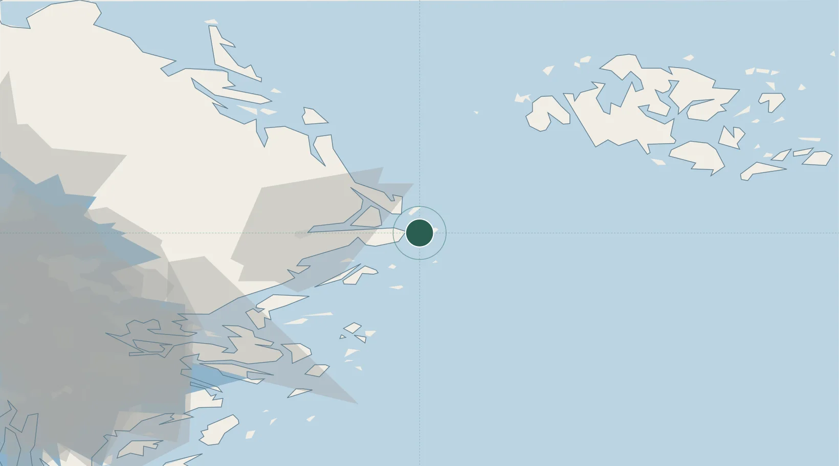
Nearby Logistics Neighbours

Cities
  1. 1Kapellskär6 km
  2. 2Norrtälje23 km
  3. 3Grisslehamn41 km
  4. 4Hallstavik43 km
  5. 5Gottby (Godby)56 km
Nearest neighbours — logibook spatial index (haversine) over the source coordinates
Ports
  1. 1Grisslehamn41 km
  2. 2Hallstavik44 km
  3. 3Mariehamn57 km
  4. 4Hargshamn60 km
  5. 5Gustavsberg66 km
Nearest neighbours — logibook spatial index (haversine) over the source coordinates
Airports
  1. 1Mariehamn Airport58 km
  2. 2Stockholm-Arlanda Airport69 km
  3. 3Stockholm-Bromma Airport81 km
  4. 4Stockholm Västerås Airport142 km
  5. 5Eskilstuna Airport144 km
Nearest neighbours — logibook spatial index (haversine) over the source coordinates
Trade Zones
  1. 1Stockholm Free Zone74 km
  2. 2Turku Free Zone187 km
  3. 3Freeport of Hanko210 km
  4. 4Free port of Ventspils297 km
  5. 5Jönköping Free Zone366 km
Nearest neighbours — logibook spatial index (haversine) over the source coordinates
DatabookThe Record of Consolidated Knowledge
Sweden beyond logistics?
Browse databook

All Sources

LocationsUN/LOCODE
UN/LOCODE — free
Portsthe NGA World Port Index
Public domain (US gov)
AirportsOurAirports
Public domain
Trade Zonesthe World Bank SEZ database
CC BY 4.0
Trade ZonesOpen Zone Map
CC BY
← Sweden locations