UN/LOCODE hub · Russia
RUMYK

Malyye Kolpani

59.5333°, 30.0667°
1
Transport functions

Transport Functions

Multimodal
UN/LOCODE

Location

Location of RUMYK
Natural Earth 10m (public domain) · Leningrad · RUMYK · 59.53, 30.07GoogleOSMYandex

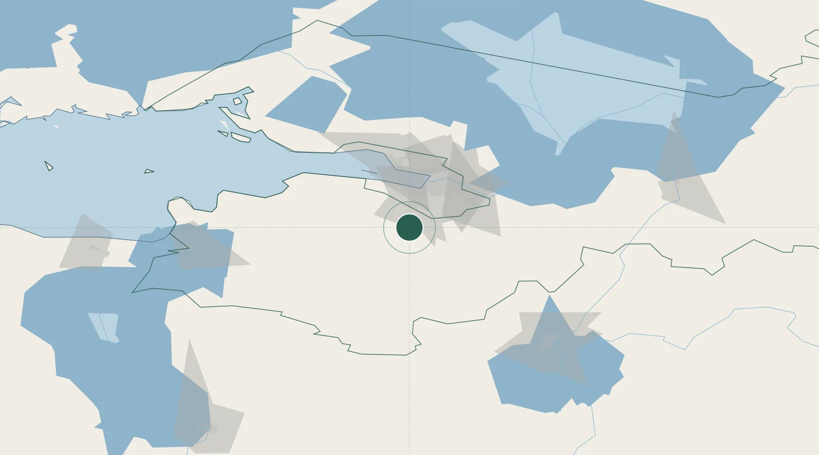
Nearby Logistics Neighbours

Cities
  1. 1Gatchina3 km
  2. 2Volosovo26 km
  3. 3Pushkin28 km
  4. 4Shushary34 km
  5. 5Saint Petersburg (ex Leningrad)38 km
Nearest neighbours — logibook spatial index (haversine) over the source coordinates
Ports
  1. 1Lomonosov46 km
  2. 2Kronshtadt53 km
  3. 3Ust Luga100 km
  4. 4Primorsk122 km
  5. 5Sillamae132 km
Nearest neighbours — logibook spatial index (haversine) over the source coordinates
Airports
  1. 1Pushkin Airport23 km
  2. 2Pulkovo Airport32 km
  3. 3Levashovo Air Base62 km
  4. 4Krechevitsy Air Base126 km
  5. 5Pribylovo Naval Air Base126 km
Nearest neighbours — logibook spatial index (haversine) over the source coordinates
Trade Zones
  1. 1St Petersburg Technology Innovative Special Economic Zone35 km
  2. 2Port of Sillamäe133 km
  3. 3Free Zone of Lappeenranta199 km
  4. 4Port of Hamina-Kotka203 km
  5. 5Moglino Special Economic Zone - Industrial227 km
Nearest neighbours — logibook spatial index (haversine) over the source coordinates
DatabookThe Record of Consolidated Knowledge
Russia beyond logistics?
Browse databook

All Sources

LocationsUN/LOCODE
UN/LOCODE — free
Portsthe NGA World Port Index
Public domain (US gov)
AirportsOurAirports
Public domain
Trade Zonesthe World Bank SEZ database
CC BY 4.0
Trade ZonesOpen Zone Map
CC BY
← Russia locations