UN/LOCODE hub · Portugal
PTAHA

Abrunheira

38.7667°, -9.3667°
1
Transport functions

Transport Functions

Multimodal
UN/LOCODE

Hub Profile

Place type
Populated place
GeoNames
Region
Lisbon
GeoNames
Time zone
Europe/Lisbon
GeoNames
Elevation
171 m
GeoNames

Location

Location of PTAHA
Natural Earth 10m (public domain) · Lisbon · PTAHA · 38.77, -9.37GoogleOSMYandex

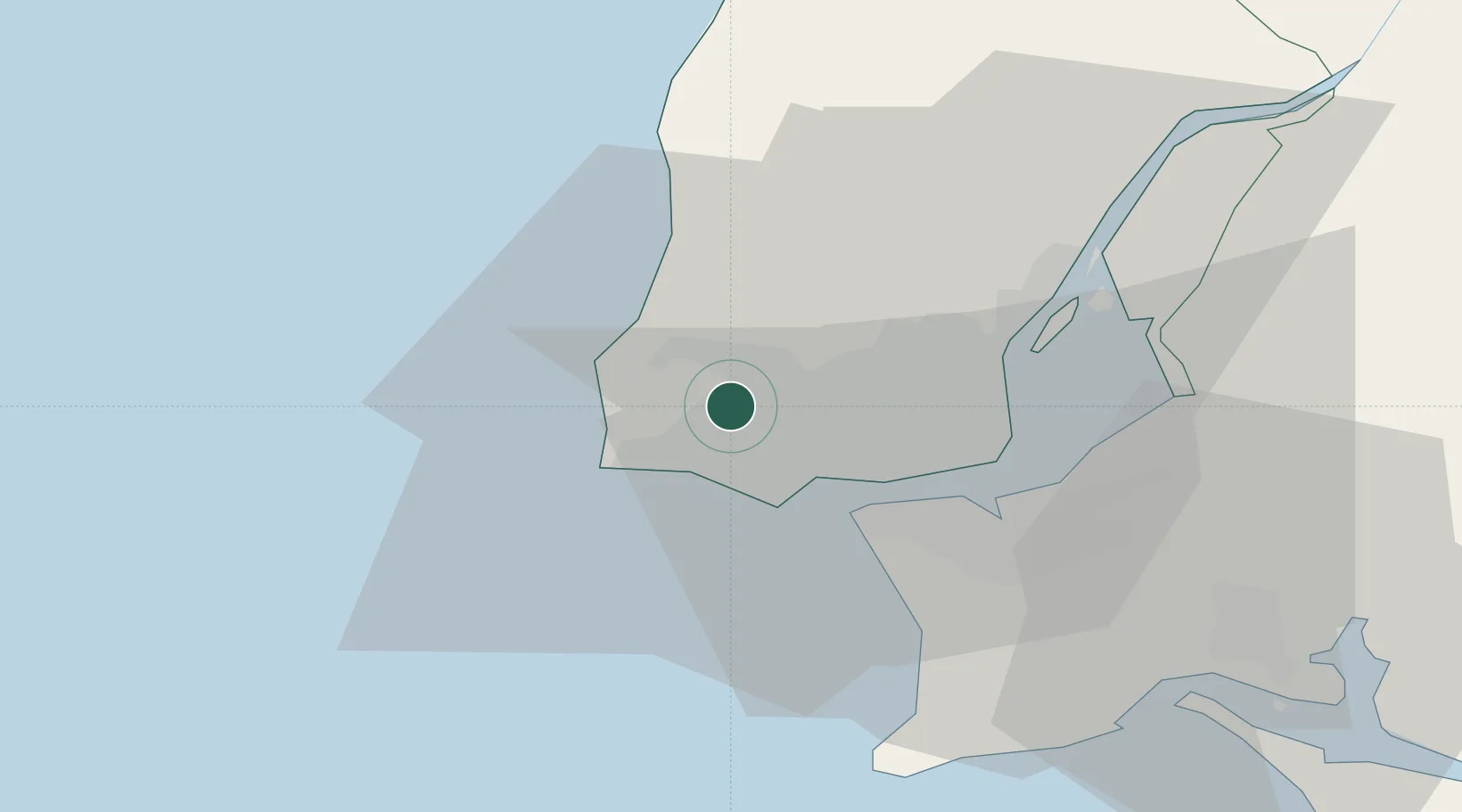
Nearby Logistics Neighbours

Cities
  1. 1Sintra4 km
  2. 2Cacém6 km
  3. 3Aboboda6 km
  4. 4Queluz de Baixo8 km
  5. 5Estoril8 km
Nearest neighbours — logibook spatial index (haversine) over the source coordinates
Ports
  1. 1Lisboa19 km
  2. 2Setubal49 km
  3. 3Sines101 km
  4. 4Figueira Da Foz160 km
  5. 5Lagos197 km
Nearest neighbours — logibook spatial index (haversine) over the source coordinates
Airports
  1. 1Cascais Airport5 km
  2. 2Sintra Air Base8 km
  3. 3Lisbon Humberto Delgado Airport20 km
  4. 4Montijo Air Base30 km
  5. 5Alverca Air Base32 km
Nearest neighbours — logibook spatial index (haversine) over the source coordinates
Trade Zones
  1. 1VGP Park Santa Maria da Feira250 km
  2. 2Puerto de Huelva269 km
  3. 3Zona Livre Tecnológica Masotinhos274 km
  4. 4Zona Franca de Sevilla335 km
  5. 5Zona Franca de Cádiz372 km
Nearest neighbours — logibook spatial index (haversine) over the source coordinates
DatabookThe Record of Consolidated Knowledge
Portugal beyond logistics?
Browse databook

All Sources

LocationsUN/LOCODE
UN/LOCODE — free
Portsthe NGA World Port Index
Public domain (US gov)
AirportsOurAirports
Public domain
Trade Zonesthe World Bank SEZ database
CC BY 4.0
Trade ZonesOpen Zone Map
CC BY
← Portugal locations