UN/LOCODE hub · Philippines
PHCBY

Calbayog, Samar

12.0667°, 124.6000°
2
Transport functions

Transport Functions

Port
Road
UN/LOCODE

Location

Location of PHCBY
Natural Earth 10m (public domain) · Samar · PHCBY · 12.07, 124.60GoogleOSMYandex

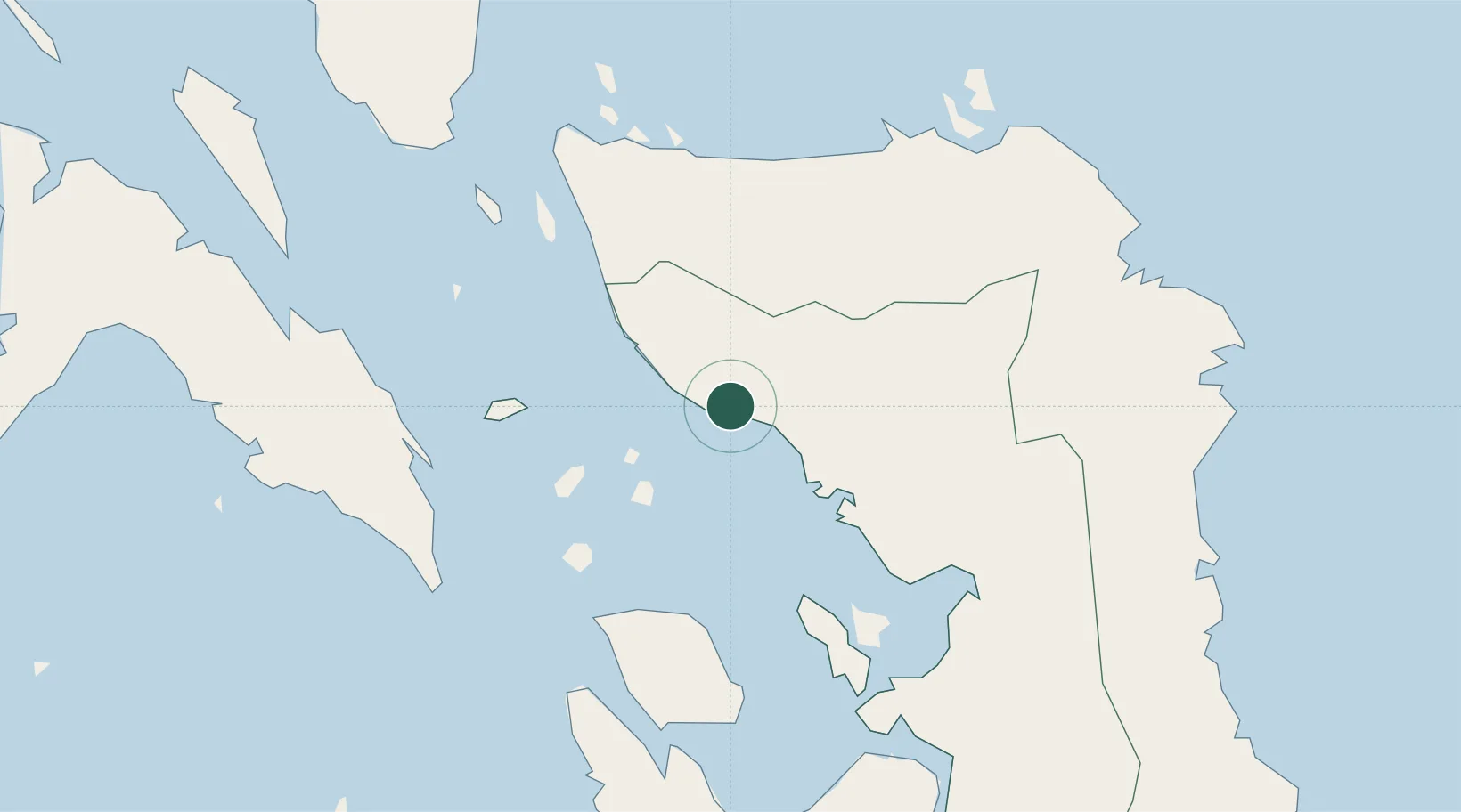
Nearby Logistics Neighbours

Cities
  1. 1Calubian, Leyte73 km
  2. 2Leyte79 km
  3. 3Capoocan85 km
  4. 4Carigara86 km
  5. 5Changtu95 km
Nearest neighbours — logibook spatial index (haversine) over the source coordinates
Ports
  1. 1Catbalogan45 km
  2. 2Tacloban101 km
  3. 3Port Borongan105 km
  4. 4Masbate112 km
  5. 5Palompon116 km
Nearest neighbours — logibook spatial index (haversine) over the source coordinates
Airports
  1. 1Calbayog Airport6 km
  2. 2Catarman National Airport49 km
  3. 3Daniel Z. Romualdez Airport104 km
  4. 4Moises R. Espinosa Airport111 km
  5. 5Ormoc Airport112 km
Nearest neighbours — logibook spatial index (haversine) over the source coordinates
Trade Zones
  1. 1Samar Agro-Industrial Economic Zone15 km
  2. 2Eastern Visayas Regional Growth Center90 km
  3. 3Kananga Special Economic Zone101 km
  4. 4Leyte Mikyu Economic Zone108 km
  5. 5Leyte Information Communication Technology Park108 km
Nearest neighbours — logibook spatial index (haversine) over the source coordinates
DatabookThe Record of Consolidated Knowledge
Philippines beyond logistics?
Browse databook

All Sources

LocationsUN/LOCODE
UN/LOCODE — free
Portsthe NGA World Port Index
Public domain (US gov)
AirportsOurAirports
Public domain
Trade Zonesthe World Bank SEZ database
CC BY 4.0
Trade ZonesOpen Zone Map
CC BY
← Philippines locations