UN/LOCODE hub · Panama
PAPEL

Perales

7.7667°, -80.3167°
230
Population
1
Transport functions

Transport Functions

Multimodal
UN/LOCODE

Hub Profile

Place type
District seat
GeoNames
Region
Los Santos Province
GeoNames
Population
230
GeoNames
Time zone
America/Panama
GeoNames
Elevation
35 m
GeoNames

Location

Location of PAPEL
Natural Earth 10m (public domain) · Los Santos Province · PAPEL · 7.77, -80.32GoogleOSMYandex

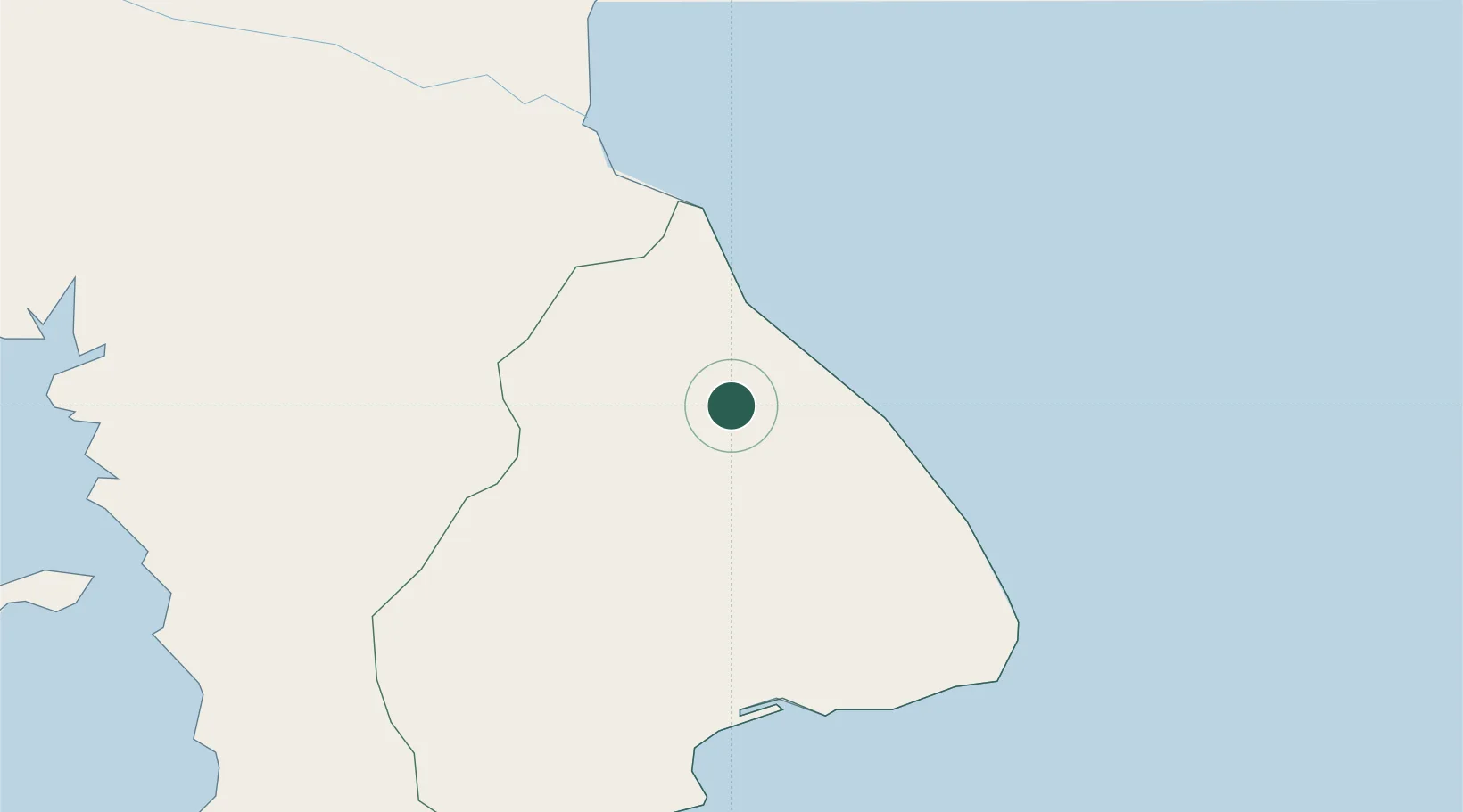
Nearby Logistics Neighbours

Cities
  1. 1Santo Domingo8 km
  2. 2Agua Buena11 km
  3. 3Bayano17 km
  4. 4Los Santos22 km
  5. 5Chitre26 km
Nearest neighbours — logibook spatial index (haversine) over the source coordinates
Ports
  1. 1Vacamonte142 km
  2. 2Punta Rincon145 km
  3. 3Balboa155 km
  4. 4Puerto Cristobal182 km
  5. 5Puerto Colon184 km
Nearest neighbours — logibook spatial index (haversine) over the source coordinates
Airports
  1. 1Alonso Valderrama Airport27 km
  2. 2Capt. J. Montenegro Airport40 km
  3. 3Scarlett Martinez International Airport71 km
  4. 4Ruben Cantu Airport78 km
  5. 5Pixvae Airstrip138 km
Nearest neighbours — logibook spatial index (haversine) over the source coordinates
Trade Zones
  1. 1Zona Franca Cobol Due27 km
  2. 2Panamá Pacífico Special Economic Area150 km
  3. 3Zona Franca Marpesca Corozal158 km
  4. 4City of Knowledge (Ciudad del Saber)159 km
  5. 5Zona Franca de Albrook160 km
Nearest neighbours — logibook spatial index (haversine) over the source coordinates
DatabookThe Record of Consolidated Knowledge
Panama beyond logistics?
Browse databook

All Sources

LocationsUN/LOCODE
UN/LOCODE — free
LocationsGeoNames
CC BY 4.0
Portsthe NGA World Port Index
Public domain (US gov)
AirportsOurAirports
Public domain
Trade Zonesthe World Bank SEZ database
CC BY 4.0
Trade ZonesOpen Zone Map
CC BY
← Panama locations