UN/LOCODE hub · Norway
NOHYL

Hyllestad

61.1667°, 5.2833°
1
Transport functions

Transport Functions

Port
UN/LOCODE

Hub Profile

Place type
Provincial seat
GeoNames
Region
Vestland
GeoNames
Time zone
Europe/Oslo
GeoNames
Elevation
130 m
GeoNames

Location

Location of NOHYL
Natural Earth 10m (public domain) · Vestland · NOHYL · 61.17, 5.28GoogleOSMYandex

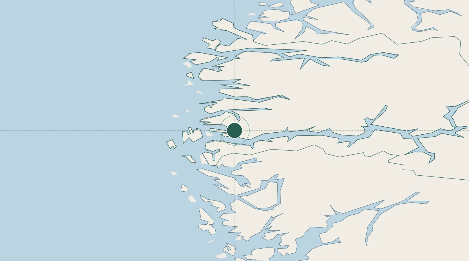
Nearby Logistics Neighbours

Cities
  1. 1Listraumen6 km
  2. 2Leirvik i Hyllestad6 km
  3. 3Rutledal12 km
  4. 4Lutelandet19 km
  5. 5Brekke19 km
Nearest neighbours — logibook spatial index (haversine) over the source coordinates
Ports
  1. 1Mongstad40 km
  2. 2Floro50 km
  3. 3Stura65 km
  4. 4Vaksdal80 km
  5. 5Bergen85 km
Nearest neighbours — logibook spatial index (haversine) over the source coordinates
Airports
  1. 1Førde Airport, Bringeland36 km
  2. 2Florø Airport48 km
  3. 3Sandane Airport, Anda86 km
  4. 4Bergen Airport, Flesland97 km
  5. 5Sogndal Airport, Haukåsen100 km
Nearest neighbours — logibook spatial index (haversine) over the source coordinates
Trade Zones
  1. 1Gothenburg Boundless Customs Warehouse533 km
  2. 2Freeport of Copenhagen- Nordhavn740 km
  3. 3MTS Malmö Transport and Spedition767 km
  4. 4North Eastern Enterprise Zone799 km
  5. 5Freeport of Kiel813 km
Nearest neighbours — logibook spatial index (haversine) over the source coordinates
DatabookThe Record of Consolidated Knowledge
Norway beyond logistics?
Browse databook

All Sources

LocationsUN/LOCODE
UN/LOCODE — free
Portsthe NGA World Port Index
Public domain (US gov)
AirportsOurAirports
Public domain
Trade Zonesthe World Bank SEZ database
CC BY 4.0
Trade ZonesOpen Zone Map
CC BY
← Norway locations