UN/LOCODE hub · Japan
JPFCH

Fuchu-shi

35.6667°, 139.4833°
2
Transport functions

Transport Functions

Rail
Road
UN/LOCODE

Hub Profile

Region
13
GeoNames

Location

Location of JPFCH
Natural Earth 10m (public domain) · 13 · JPFCH · 35.67, 139.48GoogleOSMYandex

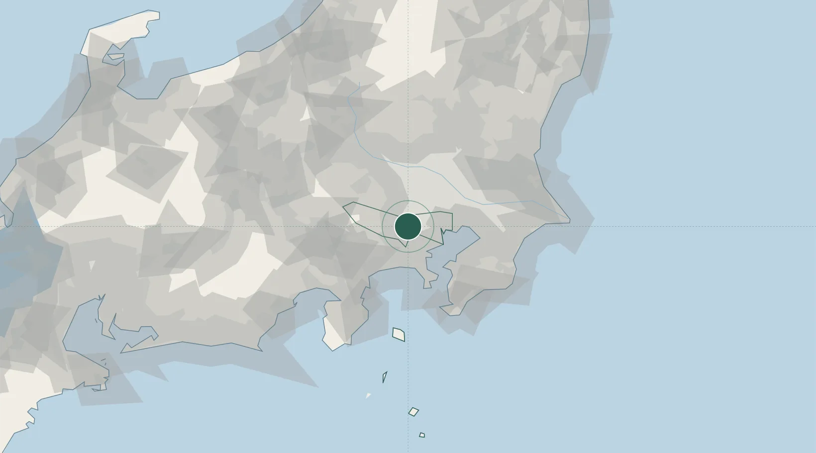
Nearby Logistics Neighbours

Cities
  1. 1Kokubunji4 km
  2. 2Kunitachi5 km
  3. 3Kodaira, Tokyo6 km
  4. 4Tachikawa6 km
  5. 5Chofu6 km
Nearest neighbours — logibook spatial index (haversine) over the source coordinates
Ports
  1. 1Tokyo Ko24 km
  2. 2Yokohama Ko26 km
  3. 3Kawasaki Ko32 km
  4. 4Funabashi42 km
  5. 5Yokosuka Ko46 km
Nearest neighbours — logibook spatial index (haversine) over the source coordinates
Airports
  1. 1Chofu Airport4 km
  2. 2Yokota Air Base15 km
  3. 3Iruma Air Base21 km
  4. 4JMSDF Atsugi Air Base / Naval Air Facility Atsugi24 km
  5. 5Tokyo Haneda International Airport30 km
Nearest neighbours — logibook spatial index (haversine) over the source coordinates
DatabookThe Record of Consolidated Knowledge
Japan beyond logistics?
Browse databook

All Sources

LocationsUN/LOCODE
UN/LOCODE — free
Portsthe NGA World Port Index
Public domain (US gov)
AirportsOurAirports
Public domain
Trade Zonesthe World Bank SEZ database
CC BY 4.0
Trade ZonesOpen Zone Map
CC BY
← Japan locations