UN/LOCODE hub · India
INTBT

TCSL SEZ/Siruseri

13.0833°, 80.2833°
2
Transport functions

Transport Functions

Road
Multimodal
UN/LOCODE

Hub Profile

Region
TN
GeoNames

Location

Location of INTBT
Natural Earth 10m (public domain) · TN · INTBT · 13.08, 80.28GoogleOSMYandex

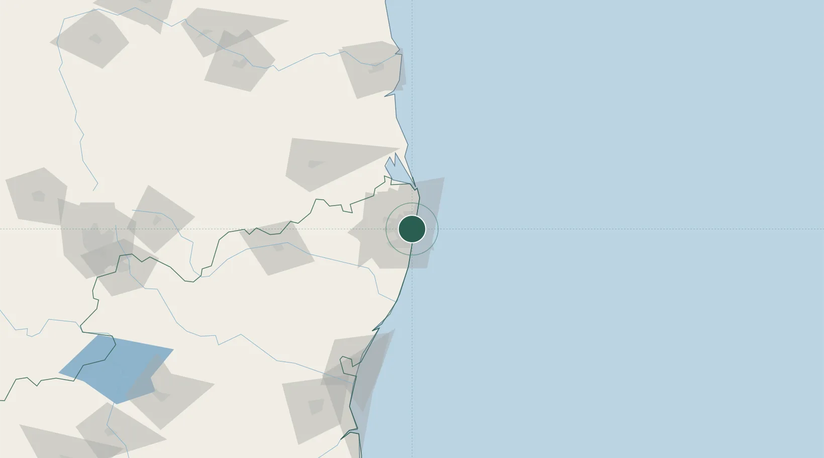
Nearby Logistics Neighbours

Cities
  1. 1TIPL SEZ/Chennai0 km
  2. 2CTSI SEZ/Siruseri0 km
  3. 3HTL SEZ/Siruseri0 km
  4. 4Choolai2 km
  5. 5Royapuram2 km
Nearest neighbours — logibook spatial index (haversine) over the source coordinates
Ports
  1. 1Chennai (Madras)3 km
  2. 2Kamarajar Port21 km
  3. 3Kattupalli Port131 km
  4. 4Pondicherry137 km
  5. 5Cuddalore162 km
Nearest neighbours — logibook spatial index (haversine) over the source coordinates
Airports
  1. 1Chennai International Airport16 km
  2. 2Tirupati International Airport101 km
  3. 3Pondicherry Airport134 km
  4. 4Kadapa Airport228 km
  5. 5Kempegowda International Airport Bengaluru279 km
Nearest neighbours — logibook spatial index (haversine) over the source coordinates
Trade Zones
  1. 1Tril Info Park3 km
  2. 2New Chennai Developers Llp3 km
  3. 3State Industries Promotion Corporation of Tamil Nadu Limited3 km
  4. 4Sipcot5 km
  5. 5CCCL Infrastructure Limited5 km
Nearest neighbours — logibook spatial index (haversine) over the source coordinates
DatabookThe Record of Consolidated Knowledge
India beyond logistics?
Browse databook

All Sources

LocationsUN/LOCODE
UN/LOCODE — free
Portsthe NGA World Port Index
Public domain (US gov)
AirportsOurAirports
Public domain
Trade Zonesthe World Bank SEZ database
CC BY 4.0
Trade ZonesOpen Zone Map
CC BY
← India locations