UN/LOCODE hub · Croatia
HRPLM

Plomin

45.1333°, 14.1667°
96
Population
2
Transport functions

Transport Functions

Port
Road
UN/LOCODE

Hub Profile

Place type
Populated place
GeoNames
Region
Istria
GeoNames
Population
96
GeoNames
Time zone
Europe/Zagreb
GeoNames
Elevation
152 m
GeoNames

Location

Location of HRPLM
Natural Earth 10m (public domain) · Istria · HRPLM · 45.13, 14.17GoogleOSMYandex

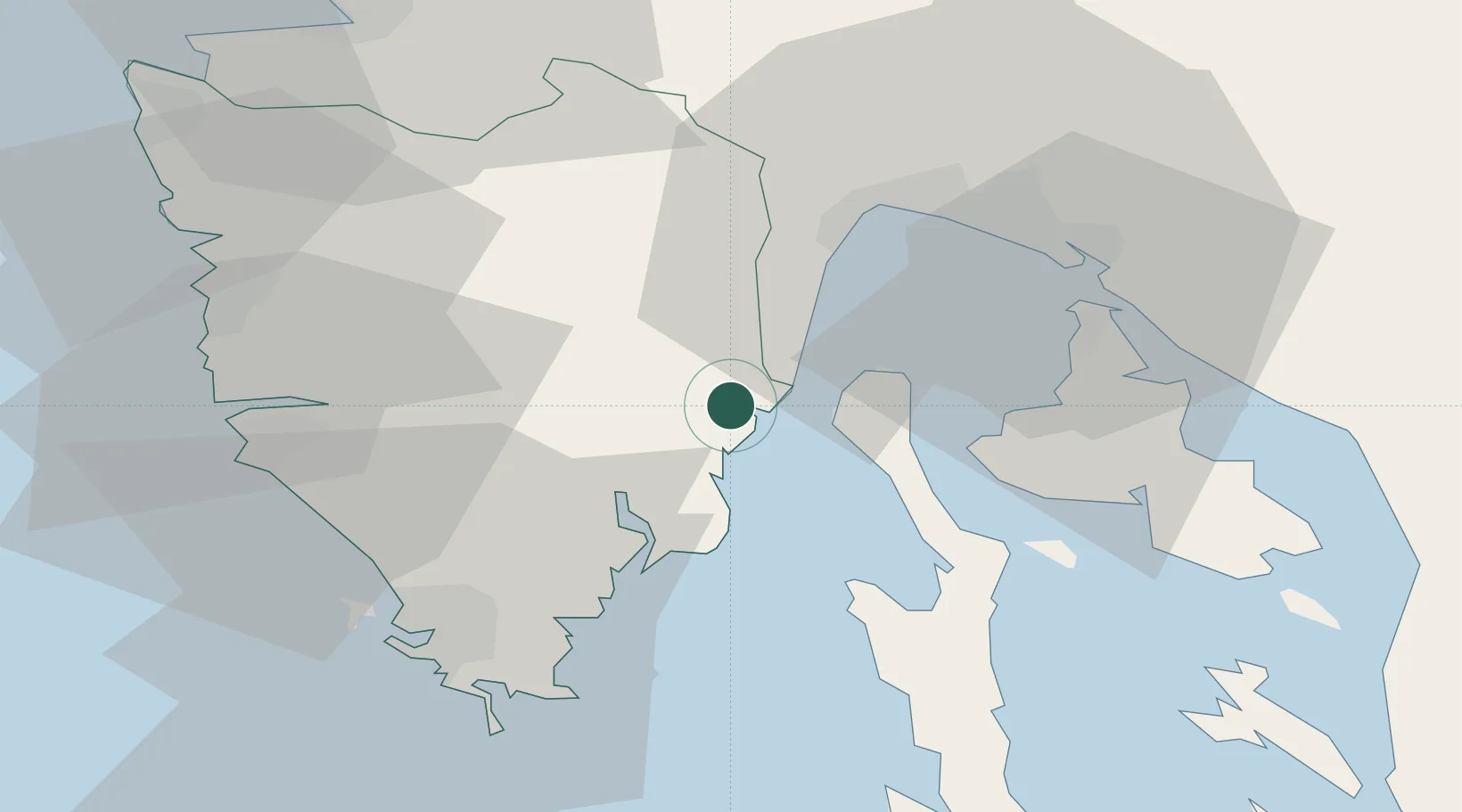
Nearby Logistics Neighbours

Cities
  1. 1Porozina3 km
  2. 2Rabac6 km
  3. 3Rasa11 km
  4. 4Moscenicka Draga13 km
  5. 5Koromacno19 km
Nearest neighbours — logibook spatial index (haversine) over the source coordinates
Ports
  1. 1Zaliv Rasa12 km
  2. 2Rijeka Luka31 km
  3. 3Omisalj31 km
  4. 4Bakar34 km
  5. 5Pula40 km
Nearest neighbours — logibook spatial index (haversine) over the source coordinates
Airports
  1. 1Pula Airport33 km
  2. 2Rijeka Airport33 km
  3. 3Portorož Airport57 km
  4. 4Trieste Airport94 km
  5. 5Ljubljana Jože Pučnik Airport123 km
Nearest neighbours — logibook spatial index (haversine) over the source coordinates
Trade Zones
  1. 1Port of Rijeka Free Zone10 km
  2. 2Free Zone Kukuljanovo35 km
  3. 3Port of Pula Free Zone40 km
  4. 4Free Port of Trieste66 km
  5. 5Free Port of Venice149 km
Nearest neighbours — logibook spatial index (haversine) over the source coordinates
DatabookThe Record of Consolidated Knowledge
Croatia beyond logistics?
Browse databook

All Sources

LocationsUN/LOCODE
UN/LOCODE — free
LocationsGeoNames
CC BY 4.0
Portsthe NGA World Port Index
Public domain (US gov)
AirportsOurAirports
Public domain
Trade Zonesthe World Bank SEZ database
CC BY 4.0
Trade ZonesOpen Zone Map
CC BY
← Croatia locations