UN/LOCODE hub · Croatia
HRCRS

Cres

44.9500°, 14.4000°
2,185
Population
2
Transport functions

Transport Functions

Port
Road
UN/LOCODE

Hub Profile

Place type
Provincial seat
GeoNames
Region
Primorje-Gorski Kotar
GeoNames
Population
2,185
GeoNames
Time zone
Europe/Zagreb
GeoNames
Elevation
11 m
GeoNames

Location

Location of HRCRS
Natural Earth 10m (public domain) · Primorje-Gorski Kotar · HRCRS · 44.95, 14.40GoogleOSMYandex

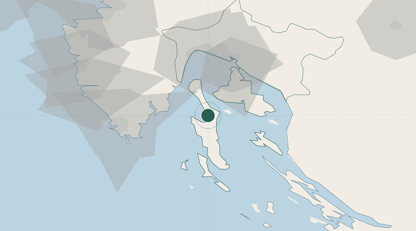
Nearby Logistics Neighbours

Cities
  1. 1Merag5 km
  2. 2Valbiska12 km
  3. 3Martinscica15 km
  4. 4Krk17 km
  5. 5Punat20 km
Nearest neighbours — logibook spatial index (haversine) over the source coordinates
Ports
  1. 1Zaliv Rasa29 km
  2. 2Omisalj32 km
  3. 3Senj40 km
  4. 4Bakar40 km
  5. 5Rijeka Luka43 km
Nearest neighbours — logibook spatial index (haversine) over the source coordinates
Airports
  1. 1Rijeka Airport33 km
  2. 2Pula Airport38 km
  3. 3Portorož Airport85 km
  4. 4Udbina Airfield117 km
  5. 5Zadar Airport121 km
Nearest neighbours — logibook spatial index (haversine) over the source coordinates
Trade Zones
  1. 1Port of Rijeka Free Zone29 km
  2. 2Free Zone Kukuljanovo44 km
  3. 3Port of Pula Free Zone46 km
  4. 4Free Port of Trieste93 km
  5. 5PJ Free Zone Zagreb149 km
Nearest neighbours — logibook spatial index (haversine) over the source coordinates
DatabookThe Record of Consolidated Knowledge
Croatia beyond logistics?
Browse databook

All Sources

LocationsUN/LOCODE
UN/LOCODE — free
LocationsGeoNames
CC BY 4.0
Portsthe NGA World Port Index
Public domain (US gov)
AirportsOurAirports
Public domain
Trade Zonesthe World Bank SEZ database
CC BY 4.0
Trade ZonesOpen Zone Map
CC BY
← Croatia locations