UN/LOCODE hub · Greece
GRSTN

Saint Nicolas

38.3500°, 22.6833°
1
Transport functions

Transport Functions

Port
UN/LOCODE

Hub Profile

Region
03
GeoNames

Location

Location of GRSTN
Natural Earth 10m (public domain) · 03 · GRSTN · 38.35, 22.68GoogleOSMYandex

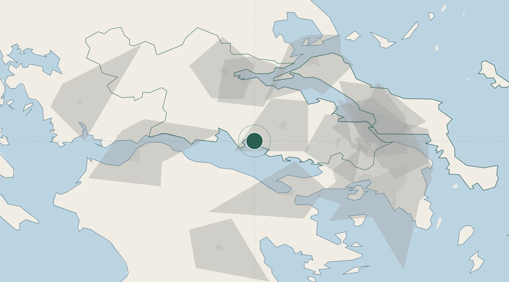
Nearby Logistics Neighbours

Cities
  1. 1Antikyra6 km
  2. 2Levadhia19 km
  3. 3Itea25 km
  4. 4Tithoréa26 km
  5. 5Galaxidi26 km
Nearest neighbours — logibook spatial index (haversine) over the source coordinates
Ports
  1. 1Itea25 km
  2. 2Aigio54 km
  3. 3Achladi62 km
  4. 4Megara Oil Terminal76 km
  5. 5Patrai84 km
Nearest neighbours — logibook spatial index (haversine) over the source coordinates
Airports
  1. 1Tanagra Air Base77 km
  2. 2Elefsis Air Base83 km
  3. 3Nea Anchialos National Airport97 km
  4. 4Patras Araxos Agamemnon Airport112 km
  5. 5Skiathos Island National Airport116 km
Nearest neighbours — logibook spatial index (haversine) over the source coordinates
Trade Zones
  1. 1Free Zone of Piraeus93 km
  2. 2Free Zone of Platigiali (Astakos Etoloakarnanias)139 km
  3. 3Free Zone of Thessaloniki255 km
  4. 4Gjirokastër Freezone289 km
  5. 5Përmet Freezone290 km
Nearest neighbours — logibook spatial index (haversine) over the source coordinates
DatabookThe Record of Consolidated Knowledge
Greece beyond logistics?
Browse databook

All Sources

LocationsUN/LOCODE
UN/LOCODE — free
Portsthe NGA World Port Index
Public domain (US gov)
AirportsOurAirports
Public domain
Trade Zonesthe World Bank SEZ database
CC BY 4.0
Trade ZonesOpen Zone Map
CC BY
← Greece locations