UN/LOCODE hub · Greece
GRGLX

Galaxidi

38.3833°, 22.3833°
1
Transport functions

Transport Functions

Port
UN/LOCODE

Hub Profile

Region
07
GeoNames

Location

Location of GRGLX
Natural Earth 10m (public domain) · 07 · GRGLX · 38.38, 22.38GoogleOSMYandex

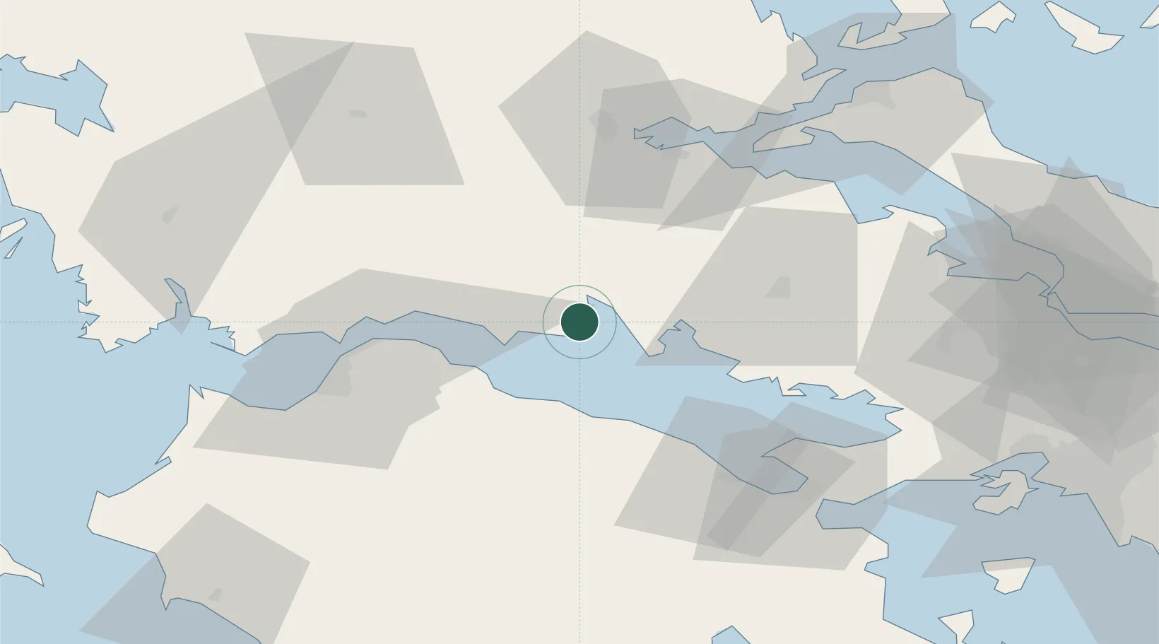
Nearby Logistics Neighbours

Cities
  1. 1Itea6 km
  2. 2Eratini13 km
  3. 3Agios Nikolaos Fokidas21 km
  4. 4Antikyra22 km
  5. 5Saint Nicolas26 km
Nearest neighbours — logibook spatial index (haversine) over the source coordinates
Ports
  1. 1Itea6 km
  2. 2Aigio30 km
  3. 3Patrai59 km
  4. 4Achladi69 km
  5. 5Mesolongion84 km
Nearest neighbours — logibook spatial index (haversine) over the source coordinates
Airports
  1. 1Patras Araxos Agamemnon Airport88 km
  2. 2Nea Anchialos National Airport100 km
  3. 3Tanagra Air Base103 km
  4. 4Andravida Air Base108 km
  5. 5Elefsis Air Base108 km
Nearest neighbours — logibook spatial index (haversine) over the source coordinates
Trade Zones
  1. 1Free Zone of Platigiali (Astakos Etoloakarnanias)112 km
  2. 2Free Zone of Piraeus118 km
  3. 3Free Zone of Thessaloniki255 km
  4. 4Gjirokastër Freezone268 km
  5. 5Përmet Freezone270 km
Nearest neighbours — logibook spatial index (haversine) over the source coordinates
DatabookThe Record of Consolidated Knowledge
Greece beyond logistics?
Browse databook

All Sources

LocationsUN/LOCODE
UN/LOCODE — free
Portsthe NGA World Port Index
Public domain (US gov)
AirportsOurAirports
Public domain
Trade Zonesthe World Bank SEZ database
CC BY 4.0
Trade ZonesOpen Zone Map
CC BY
← Greece locations