UN/LOCODE hub · Greece
GRPET

Pétra Lesvou

38.3667°, 23.0667°
2
Transport functions

Transport Functions

Rail
Road
UN/LOCODE

Hub Profile

Region
83
GeoNames

Location

Location of GRPET
Natural Earth 10m (public domain) · 83 · GRPET · 38.37, 23.07GoogleOSMYandex

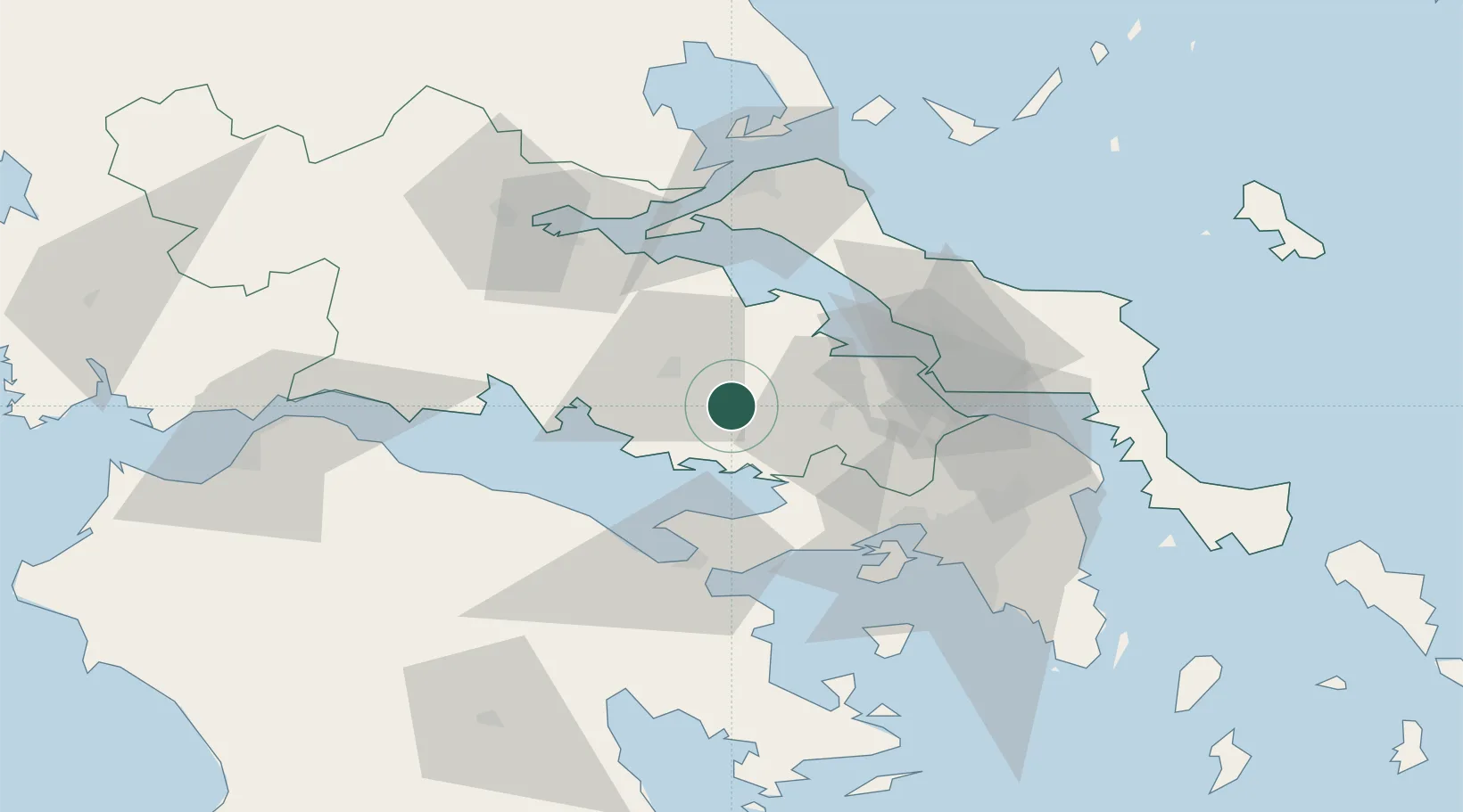
Nearby Logistics Neighbours

Cities
  1. 1Voiotia8 km
  2. 2Levadhia19 km
  3. 3Dombraina Boiotias20 km
  4. 4Thisvi Port20 km
  5. 5Erythres28 km
Nearest neighbours — logibook spatial index (haversine) over the source coordinates
Ports
  1. 1Megara Oil Terminal53 km
  2. 2Itea57 km
  3. 3Kymassi63 km
  4. 4Achladi63 km
  5. 5Piraievs70 km
Nearest neighbours — logibook spatial index (haversine) over the source coordinates
Airports
  1. 1Tanagra Air Base44 km
  2. 2Elefsis Air Base54 km
  3. 3Athens Eleftherios Venizelos International Airport90 km
  4. 4Nea Anchialos National Airport98 km
  5. 5Skiathos Island National Airport98 km
Nearest neighbours — logibook spatial index (haversine) over the source coordinates
Trade Zones
  1. 1Free Zone of Piraeus67 km
  2. 2Free Zone of Platigiali (Astakos Etoloakarnanias)172 km
  3. 3Free Zone of Thessaloniki253 km
  4. 4Përmet Freezone313 km
  5. 5Gjirokastër Freezone314 km
Nearest neighbours — logibook spatial index (haversine) over the source coordinates
DatabookThe Record of Consolidated Knowledge
Greece beyond logistics?
Browse databook

All Sources

LocationsUN/LOCODE
UN/LOCODE — free
Portsthe NGA World Port Index
Public domain (US gov)
AirportsOurAirports
Public domain
Trade Zonesthe World Bank SEZ database
CC BY 4.0
Trade ZonesOpen Zone Map
CC BY
← Greece locations