UN/LOCODE hub · Greece
GRP5T

Platy

40.6333°, 22.5333°
2,228
Population
2
Transport functions

Transport Functions

Port
Road
UN/LOCODE

Hub Profile

Place type
Populated place
GeoNames
Region
Central Macedonia
GeoNames
Population
2,228
GeoNames
Time zone
Europe/Athens
GeoNames
Elevation
5 m
GeoNames

Location

Location of GRP5T
Natural Earth 10m (public domain) · Central Macedonia · GRP5T · 40.63, 22.53GoogleOSMYandex

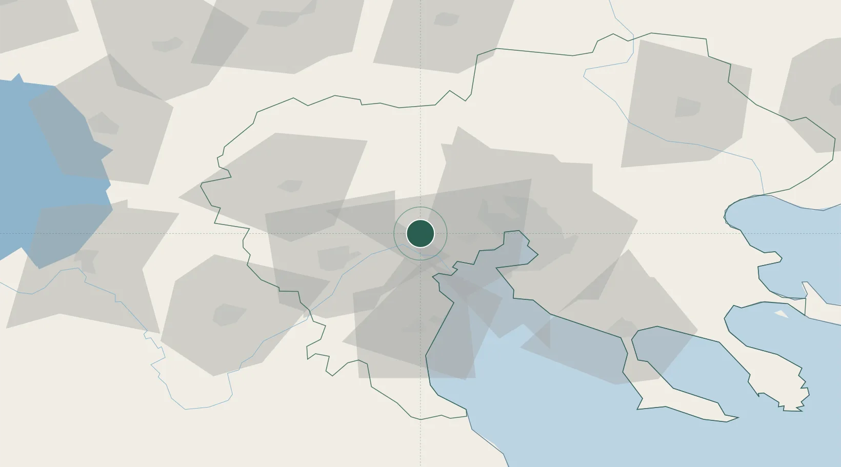
Nearby Logistics Neighbours

Cities
  1. 1Áhdendron7 km
  2. 2Eginion17 km
  3. 3Giannitsa20 km
  4. 4Ankhíalos23 km
  5. 5Pendálofos29 km
Nearest neighbours — logibook spatial index (haversine) over the source coordinates
Ports
  1. 1Thessaloniki34 km
  2. 2Yerakini89 km
  3. 3Stratoni111 km
  4. 4Volos145 km
  5. 5Kavala161 km
Nearest neighbours — logibook spatial index (haversine) over the source coordinates
Airports
  1. 1Thessaloniki Macedonia International Airport39 km
  2. 2Kozani National Airport Filippos70 km
  3. 3Kastoria National Airport Aristotle108 km
  4. 4Nea Anchialos National Airport159 km
  5. 5Ohrid St. Paul the Apostle Airport162 km
Nearest neighbours — logibook spatial index (haversine) over the source coordinates
Trade Zones
  1. 1Free Zone of Thessaloniki33 km
  2. 2TIDZ Gevgelija63 km
  3. 3TIDZ Strumica85 km
  4. 4TIDZ Radoviš111 km
  5. 5TIDZ Prilep113 km
Nearest neighbours — logibook spatial index (haversine) over the source coordinates
DatabookThe Record of Consolidated Knowledge
Greece beyond logistics?
Browse databook

All Sources

LocationsUN/LOCODE
UN/LOCODE — free
LocationsGeoNames
CC BY 4.0
Portsthe NGA World Port Index
Public domain (US gov)
AirportsOurAirports
Public domain
Trade Zonesthe World Bank SEZ database
CC BY 4.0
Trade ZonesOpen Zone Map
CC BY
← Greece locations